
O22A Kremmling, CO, USA - Earthquake Result Viewer
| ||||||||||||||||||
| ||||||||||||||||||
| ||||||||||||||||||
|
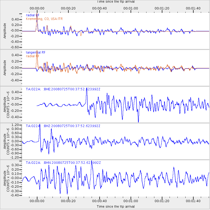
Signal To Noise
| Channel | StoN | STA | LTA |
| TA:O22A: :BHZ:20080725T00:37:52.623992Z | 8.613259 | 4.8553363E-7 | 5.637049E-8 |
| TA:O22A: :BHN:20080725T00:37:52.623992Z | 2.6423728 | 1.2134143E-7 | 4.592139E-8 |
| TA:O22A: :BHE:20080725T00:37:52.623992Z | 6.9744143 | 2.0039248E-7 | 2.8732517E-8 |
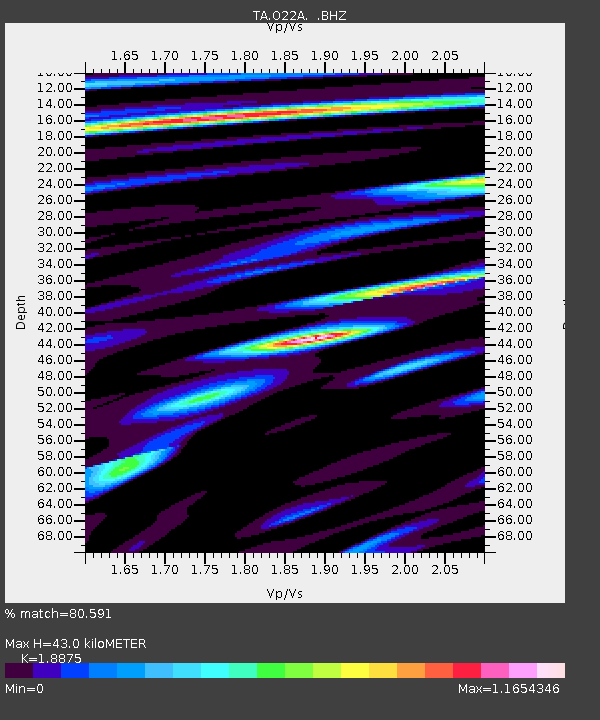
| Arrivals | |
| Ps | 6.5 SECOND |
| PpPs | 19 SECOND |
| PsPs/PpSs | 26 SECOND |

