O22A Kremmling, CO, USA - Earthquake Result Viewer
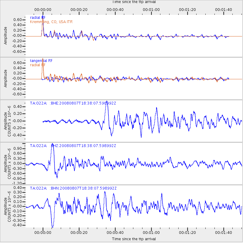
Earthquake location: Andreanof Islands, Aleutian Is.
Earthquake latitude/longitude: 52.2/-175.7
Earthquake time(UTC): 2008/08/07 (220) 18:30:03 GMT
Earthquake Depth: 12 km
Earthquake Magnitude: 5.6 MB, 5.5 MS, 5.8 MW, 5.8 MW
Earthquake Catalog/Contributor: WHDF/NEIC
Network: TA USArray Transportable Network (new EarthScope stations)
Station: O22A Kremmling, CO, USA
Lat/Lon: 40.16 N/106.55 W
Elevation: 2747 m
Distance: 47.6 deg
Az: 75.882 deg
Baz: 308.828 deg
Ray Param: 0.06989074
Estimated Moho Depth: 46.5 km
Estimated Crust Vp/Vs: 1.99
Assumed Crust Vp: 6.159 km/s
Estimated Crust Vs: 3.095 km/s
Estimated Crust Poisson's Ratio: 0.33
Radial Match: 88.37563 %
Radial Bump: 400
Transverse Match: 77.50215 %
Transverse Bump: 400
SOD ConfigId: 2504
Insert Time: 2010-03-06 11:14:25.531 +0000
GWidth: 2.5
Max Bumps: 400
Tol: 0.001

Signal To Noise

ChannelStoNSTALTA
TA:O22A: :BHZ:20080807T18:38:07.598992Z9.3729243.0755928E-73.281359E-8
TA:O22A: :BHN:20080807T18:38:07.598992Z4.72226861.0427576E-72.208171E-8
TA:O22A: :BHE:20080807T18:38:07.598992Z5.85246231.3883786E-72.3722983E-8
Arrivals
Ps7.9 SECOND
PpPs21 SECOND
PsPs/PpSs29 SECOND