O22A Kremmling, CO, USA - Earthquake Result Viewer
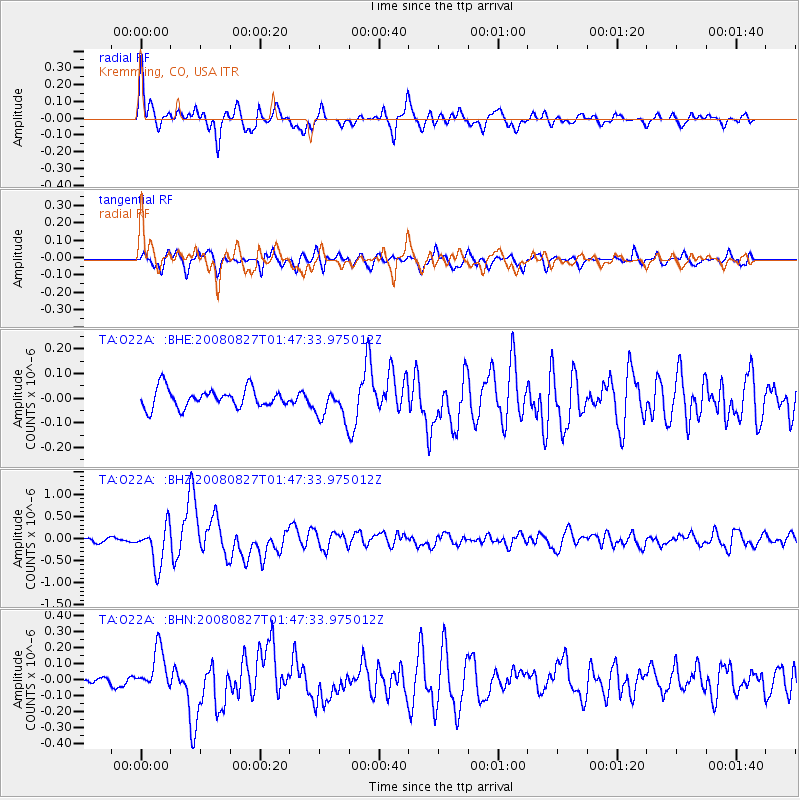
Earthquake location: Lake Baykal Region, Russia
Earthquake latitude/longitude: 51.6/104.2
Earthquake time(UTC): 2008/08/27 (240) 01:35:32 GMT
Earthquake Depth: 16 km
Earthquake Magnitude: 5.8 MB, 6.2 MS, 6.2 MW, 6.2 MW
Earthquake Catalog/Contributor: WHDF/NEIC
Network: TA USArray Transportable Network (new EarthScope stations)
Station: O22A Kremmling, CO, USA
Lat/Lon: 40.16 N/106.55 W
Elevation: 2747 m
Distance: 84.8 deg
Az: 23.139 deg
Baz: 341.351 deg
Ray Param: 0.045239408
Estimated Moho Depth: 53.0 km
Estimated Crust Vp/Vs: 1.70
Assumed Crust Vp: 6.159 km/s
Estimated Crust Vs: 3.628 km/s
Estimated Crust Poisson's Ratio: 0.23
Radial Match: 82.662315 %
Radial Bump: 400
Transverse Match: 75.999794 %
Transverse Bump: 400
SOD ConfigId: 2504
Insert Time: 2010-03-06 11:14:35.839 +0000
GWidth: 2.5
Max Bumps: 400
Tol: 0.001

Signal To Noise

ChannelStoNSTALTA
TA:O22A: :BHZ:20080827T01:47:33.975012Z8.6934454.563913E-75.2498322E-8
TA:O22A: :BHN:20080827T01:47:33.975012Z3.37160441.2802394E-73.7971226E-8
TA:O22A: :BHE:20080827T01:47:33.975012Z1.72293036.608515E-83.8356255E-8
Arrivals
Ps6.1 SECOND
PpPs23 SECOND
PsPs/PpSs29 SECOND