
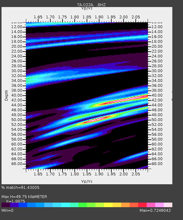
O22A Kremmling, CO, USA - Earthquake Result Viewer
| ||||||||||||||||||
| ||||||||||||||||||
| ||||||||||||||||||
|
Signal To Noise
| Channel | StoN | STA | LTA |
| TA:O22A: :BHZ:20080929T15:32:22.873997Z | 3.648069 | 3.118104E-7 | 8.547273E-8 |
| TA:O22A: :BHN:20080929T15:32:22.873997Z | 1.2058914 | 8.748533E-8 | 7.254827E-8 |
| TA:O22A: :BHE:20080929T15:32:22.873997Z | 1.0760643 | 1.10721864E-7 | 1.0289521E-7 |
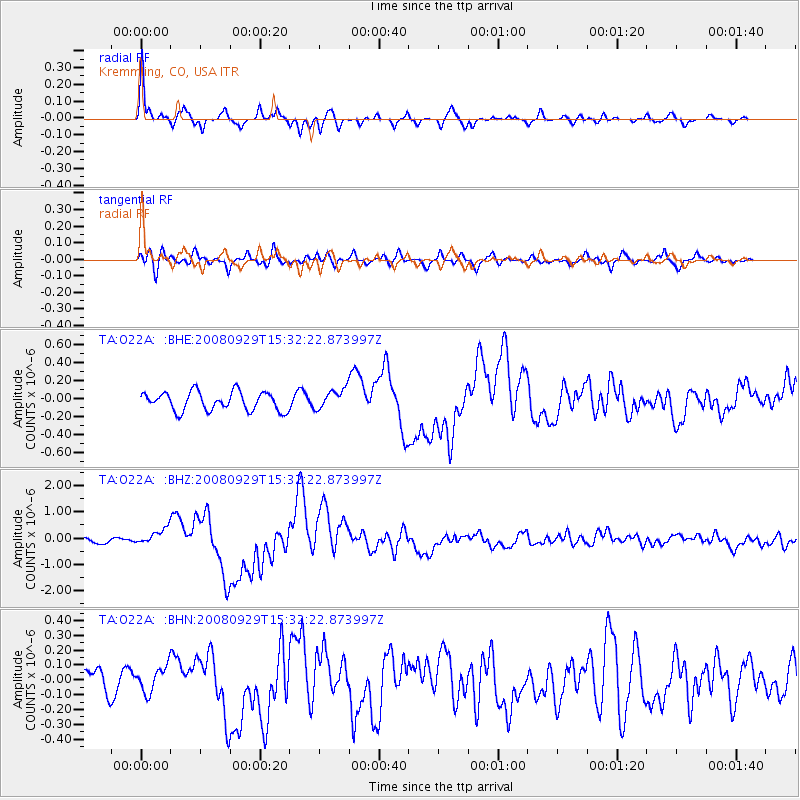
| Arrivals | |
| Ps | 7.3 SECOND |
| PpPs | 23 SECOND |
| PsPs/PpSs | 30 SECOND |

