TOV Thousand Oaks, California, USA - Earthquake Result Viewer
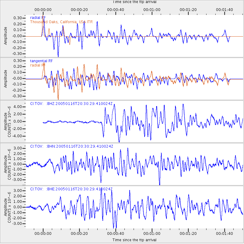
Earthquake location: W. Caroline Islands, Micronesia
Earthquake latitude/longitude: 10.9/140.8
Earthquake time(UTC): 2005/01/16 (016) 20:17:52 GMT
Earthquake Depth: 25 km
Earthquake Magnitude: 6.3 MB, 6.7 MS, 6.6 MW, 6.6 MW
Earthquake Catalog/Contributor: WHDF/NEIC
Network: CI Caltech Regional Seismic Network
Station: TOV Thousand Oaks, California, USA
Lat/Lon: 34.16 N/118.82 W
Elevation: 50 m
Distance: 92.3 deg
Az: 54.733 deg
Baz: 284.773 deg
Ray Param: 0.041467637
Estimated Moho Depth: 62.75 km
Estimated Crust Vp/Vs: 1.96
Assumed Crust Vp: 6.1 km/s
Estimated Crust Vs: 3.12 km/s
Estimated Crust Poisson's Ratio: 0.32
Radial Match: 84.29622 %
Radial Bump: 400
Transverse Match: 79.65037 %
Transverse Bump: 400
SOD ConfigId: 5233
Insert Time: 2010-02-26 01:58:05.354 +0000
GWidth: 2.5
Max Bumps: 400
Tol: 0.001

Signal To Noise

ChannelStoNSTALTA
CI:TOV: :BHN:20050116T20:30:29.410024Z2.20395115.319196E-72.413482E-7
CI:TOV: :BHE:20050116T20:30:29.410024Z2.38399964.821585E-72.0224773E-7
CI:TOV: :BHZ:20050116T20:30:29.410024Z10.7949721.6814716E-61.5576433E-7
Arrivals
Ps10.0 SECOND
PpPs30 SECOND
PsPs/PpSs40 SECOND