You are here: Home > Network List > TA - USArray Transportable Network (new EarthScope stations) Stations List
> Station L20K Farewell, AK, USA > Earthquake Result Viewer
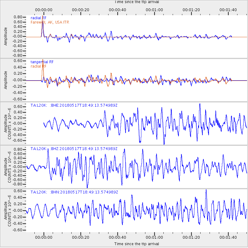
L20K Farewell, AK, USA - Earthquake Result Viewer
*The percent match for this event was below the threshold and hence no stack was calculated.
| Earthquake location: |
Hokkaido, Japan Region |
| Earthquake latitude/longitude: |
42.7/145.6 |
| Earthquake time(UTC): |
2018/05/17 (137) 18:42:10 GMT |
| Earthquake Depth: |
10 km |
| Earthquake Magnitude: |
5.8 Mww |
| Earthquake Catalog/Contributor: |
NEIC PDE/us |
|
| Network: |
TA USArray Transportable Network (new EarthScope stations) |
| Station: |
L20K Farewell, AK, USA |
| Lat/Lon: |
62.48 N/153.88 W |
| Elevation: |
673 m |
|
| Distance: |
39.9 deg |
| Az: |
39.039 deg |
| Baz: |
269.314 deg |
| Ray Param: |
$rayparam |
*The percent match for this event was below the threshold and hence was not used in the summary stack. |
|
| Radial Match: |
76.26182 % |
| Radial Bump: |
400 |
| Transverse Match: |
56.07936 % |
| Transverse Bump: |
400 |
| SOD ConfigId: |
13570011 |
| Insert Time: |
2019-04-30 06:39:25.000 +0000 |
| GWidth: |
2.5 |
| Max Bumps: |
400 |
| Tol: |
0.001 |
|
Signal To Noise
| Channel | StoN | STA | LTA |
| TA:L20K: :BHZ:20180517T18:49:13.574989Z | 3.5370018 | 3.3479063E-7 | 9.465379E-8 |
| TA:L20K: :BHN:20180517T18:49:13.574989Z | 1.3666067 | 1.2920093E-7 | 9.454141E-8 |
| TA:L20K: :BHE:20180517T18:49:13.574989Z | 2.2616217 | 2.1981722E-7 | 9.719451E-8 |
| Arrivals |
| Ps | |
| PpPs | |
| PsPs/PpSs | |


