You are here: Home > Network List > TA - USArray Transportable Network (new EarthScope stations) Stations List
> Station N23A Red Feather Lakes, CO, USA > Earthquake Result Viewer
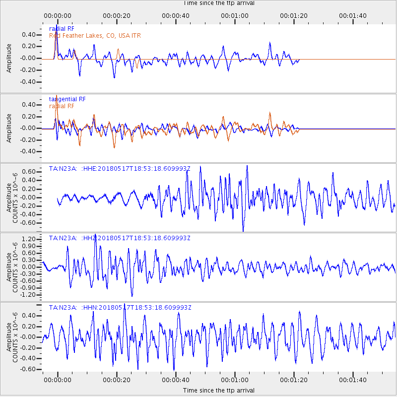
N23A Red Feather Lakes, CO, USA - Earthquake Result Viewer
*The percent match for this event was below the threshold and hence no stack was calculated.
| Earthquake location: |
Hokkaido, Japan Region |
| Earthquake latitude/longitude: |
42.7/145.6 |
| Earthquake time(UTC): |
2018/05/17 (137) 18:42:10 GMT |
| Earthquake Depth: |
10 km |
| Earthquake Magnitude: |
5.8 Mww |
| Earthquake Catalog/Contributor: |
NEIC PDE/us |
|
| Network: |
TA USArray Transportable Network (new EarthScope stations) |
| Station: |
N23A Red Feather Lakes, CO, USA |
| Lat/Lon: |
40.89 N/105.94 W |
| Elevation: |
2458 m |
|
| Distance: |
74.7 deg |
| Az: |
48.198 deg |
| Baz: |
313.517 deg |
| Ray Param: |
$rayparam |
*The percent match for this event was below the threshold and hence was not used in the summary stack. |
|
| Radial Match: |
73.21009 % |
| Radial Bump: |
400 |
| Transverse Match: |
76.511246 % |
| Transverse Bump: |
400 |
| SOD ConfigId: |
13570011 |
| Insert Time: |
2019-04-30 06:39:49.916 +0000 |
| GWidth: |
2.5 |
| Max Bumps: |
400 |
| Tol: |
0.001 |
|
Signal To Noise
| Channel | StoN | STA | LTA |
| TA:N23A: :HHZ:20180517T18:53:18.609993Z | 3.188242 | 3.7968718E-7 | 1.19089826E-7 |
| TA:N23A: :HHN:20180517T18:53:18.609993Z | 2.8418453 | 2.1620504E-7 | 7.60791E-8 |
| TA:N23A: :HHE:20180517T18:53:18.609993Z | 2.3916247 | 1.7080387E-7 | 7.141751E-8 |
| Arrivals |
| Ps | |
| PpPs | |
| PsPs/PpSs | |


