You are here: Home > Network List > TA - USArray Transportable Network (new EarthScope stations) Stations List
> Station P17K Kvichak River, AK, USA > Earthquake Result Viewer
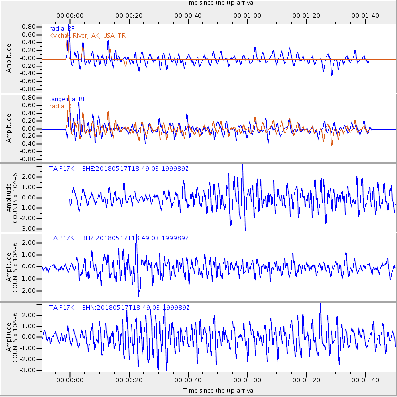
P17K Kvichak River, AK, USA - Earthquake Result Viewer
*The percent match for this event was below the threshold and hence no stack was calculated.
| Earthquake location: |
Hokkaido, Japan Region |
| Earthquake latitude/longitude: |
42.7/145.6 |
| Earthquake time(UTC): |
2018/05/17 (137) 18:42:10 GMT |
| Earthquake Depth: |
10 km |
| Earthquake Magnitude: |
5.8 Mww |
| Earthquake Catalog/Contributor: |
NEIC PDE/us |
|
| Network: |
TA USArray Transportable Network (new EarthScope stations) |
| Station: |
P17K Kvichak River, AK, USA |
| Lat/Lon: |
59.20 N/156.44 W |
| Elevation: |
91 m |
|
| Distance: |
38.7 deg |
| Az: |
44.246 deg |
| Baz: |
271.111 deg |
| Ray Param: |
$rayparam |
*The percent match for this event was below the threshold and hence was not used in the summary stack. |
|
| Radial Match: |
75.201195 % |
| Radial Bump: |
400 |
| Transverse Match: |
73.10989 % |
| Transverse Bump: |
400 |
| SOD ConfigId: |
13570011 |
| Insert Time: |
2019-04-30 06:40:01.222 +0000 |
| GWidth: |
2.5 |
| Max Bumps: |
400 |
| Tol: |
0.001 |
|
Signal To Noise
| Channel | StoN | STA | LTA |
| TA:P17K: :BHZ:20180517T18:49:03.199989Z | 2.1300247 | 4.2824996E-7 | 2.0105401E-7 |
| TA:P17K: :BHN:20180517T18:49:03.199989Z | 1.0575585 | 5.1054406E-7 | 4.8275723E-7 |
| TA:P17K: :BHE:20180517T18:49:03.199989Z | 1.0376761 | 5.2719827E-7 | 5.080567E-7 |
| Arrivals |
| Ps | |
| PpPs | |
| PsPs/PpSs | |


