You are here: Home > Network List > TA - USArray Transportable Network (new EarthScope stations) Stations List
> Station O22A Kremmling, CO, USA > Earthquake Result Viewer
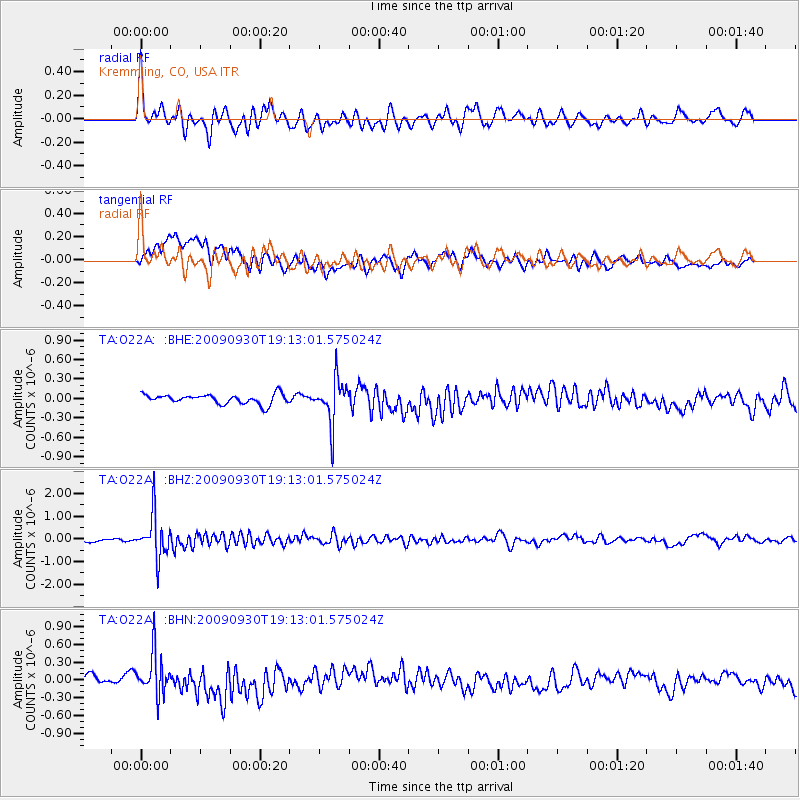
O22A Kremmling, CO, USA - Earthquake Result Viewer
*The percent match for this event was below the threshold and hence no stack was calculated.
| Earthquake location: |
Peru-Bolivia Border Region |
| Earthquake latitude/longitude: |
-15.6/-69.3 |
| Earthquake time(UTC): |
2009/09/30 (273) 19:03:17 GMT |
| Earthquake Depth: |
255 km |
| Earthquake Magnitude: |
5.9 MB, 5.8 MW |
| Earthquake Catalog/Contributor: |
WHDF/NEIC |
|
| Network: |
TA USArray Transportable Network (new EarthScope stations) |
| Station: |
O22A Kremmling, CO, USA |
| Lat/Lon: |
40.16 N/106.55 W |
| Elevation: |
2747 m |
|
| Distance: |
65.4 deg |
| Az: |
329.313 deg |
| Baz: |
140.068 deg |
| Ray Param: |
$rayparam |
*The percent match for this event was below the threshold and hence was not used in the summary stack. |
|
| Radial Match: |
71.946304 % |
| Radial Bump: |
400 |
| Transverse Match: |
56.79335 % |
| Transverse Bump: |
400 |
| SOD ConfigId: |
2622 |
| Insert Time: |
2010-03-06 11:16:47.960 +0000 |
| GWidth: |
2.5 |
| Max Bumps: |
400 |
| Tol: |
0.001 |
|
Signal To Noise
| Channel | StoN | STA | LTA |
| TA:O22A: :BHZ:20090930T19:13:01.575024Z | 13.324167 | 9.4766307E-7 | 7.112362E-8 |
| TA:O22A: :BHN:20090930T19:13:01.575024Z | 5.523759 | 3.535688E-7 | 6.400873E-8 |
| TA:O22A: :BHE:20090930T19:13:01.575024Z | 4.5836005 | 3.3867212E-7 | 7.388779E-8 |
| Arrivals |
| Ps | |
| PpPs | |
| PsPs/PpSs | |


