You are here: Home > Network List > UW - Pacific Northwest Regional Seismic Network Stations List
> Station UMAT Pilot Rock, OR, USA > Earthquake Result Viewer
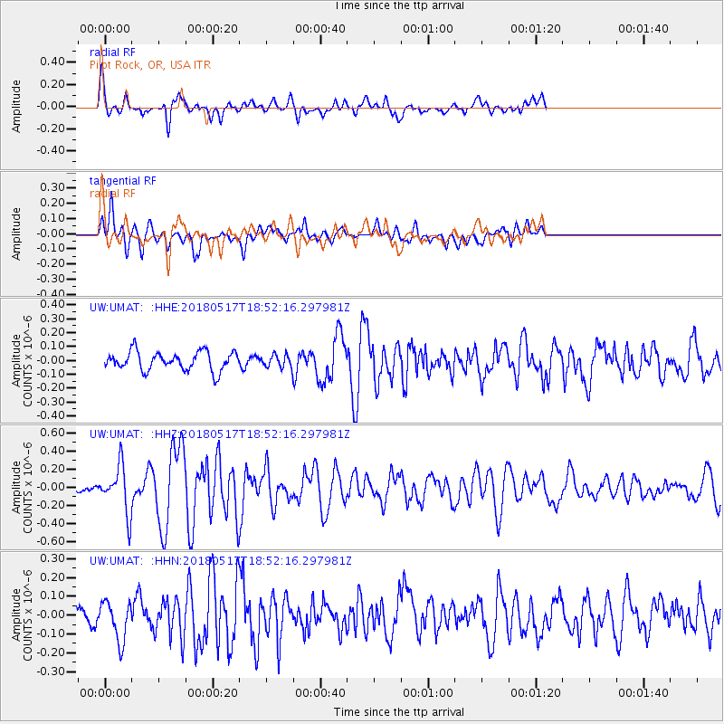
UMAT Pilot Rock, OR, USA - Earthquake Result Viewer
*The percent match for this event was below the threshold and hence no stack was calculated.
| Earthquake location: |
Hokkaido, Japan Region |
| Earthquake latitude/longitude: |
42.7/145.6 |
| Earthquake time(UTC): |
2018/05/17 (137) 18:42:10 GMT |
| Earthquake Depth: |
10 km |
| Earthquake Magnitude: |
5.8 Mww |
| Earthquake Catalog/Contributor: |
NEIC PDE/us |
|
| Network: |
UW Pacific Northwest Regional Seismic Network |
| Station: |
UMAT Pilot Rock, OR, USA |
| Lat/Lon: |
45.29 N/118.96 W |
| Elevation: |
1318 m |
|
| Distance: |
64.6 deg |
| Az: |
51.075 deg |
| Baz: |
305.634 deg |
| Ray Param: |
$rayparam |
*The percent match for this event was below the threshold and hence was not used in the summary stack. |
|
| Radial Match: |
75.05956 % |
| Radial Bump: |
400 |
| Transverse Match: |
62.09066 % |
| Transverse Bump: |
400 |
| SOD ConfigId: |
13570011 |
| Insert Time: |
2019-04-30 06:41:23.786 +0000 |
| GWidth: |
2.5 |
| Max Bumps: |
400 |
| Tol: |
0.001 |
|
Signal To Noise
| Channel | StoN | STA | LTA |
| UW:UMAT: :HHZ:20180517T18:52:16.297981Z | 3.1343021 | 2.6659416E-7 | 8.5056946E-8 |
| UW:UMAT: :HHN:20180517T18:52:16.297981Z | 1.4981258 | 1.0853845E-7 | 7.2449495E-8 |
| UW:UMAT: :HHE:20180517T18:52:16.297981Z | 1.0457658 | 7.054432E-8 | 6.745709E-8 |
| Arrivals |
| Ps | |
| PpPs | |
| PsPs/PpSs | |


