You are here: Home > Network List > TA - USArray Transportable Network (new EarthScope stations) Stations List
> Station O22A Kremmling, CO, USA > Earthquake Result Viewer
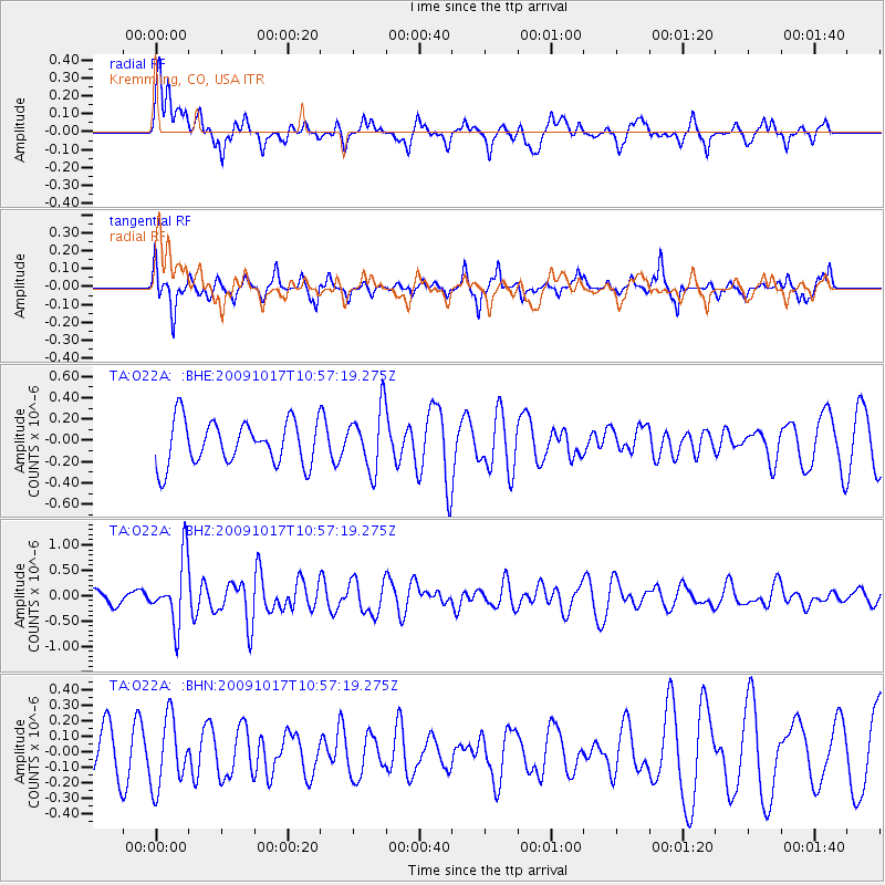
O22A Kremmling, CO, USA - Earthquake Result Viewer
*The percent match for this event was below the threshold and hence no stack was calculated.
| Earthquake location: |
Samoa Islands Region |
| Earthquake latitude/longitude: |
-16.4/-172.0 |
| Earthquake time(UTC): |
2009/10/17 (290) 10:45:26 GMT |
| Earthquake Depth: |
10 km |
| Earthquake Magnitude: |
5.7 MB, 5.3 MS, 5.7 MW, 5.7 MW |
| Earthquake Catalog/Contributor: |
WHDF/NEIC |
|
| Network: |
TA USArray Transportable Network (new EarthScope stations) |
| Station: |
O22A Kremmling, CO, USA |
| Lat/Lon: |
40.16 N/106.55 W |
| Elevation: |
2747 m |
|
| Distance: |
82.8 deg |
| Az: |
44.637 deg |
| Baz: |
241.66 deg |
| Ray Param: |
$rayparam |
*The percent match for this event was below the threshold and hence was not used in the summary stack. |
|
| Radial Match: |
50.707466 % |
| Radial Bump: |
400 |
| Transverse Match: |
53.51937 % |
| Transverse Bump: |
305 |
| SOD ConfigId: |
2622 |
| Insert Time: |
2010-03-06 11:16:59.471 +0000 |
| GWidth: |
2.5 |
| Max Bumps: |
400 |
| Tol: |
0.001 |
|
Signal To Noise
| Channel | StoN | STA | LTA |
| TA:O22A: :BHZ:20091017T10:57:19.275Z | 3.5117042 | 6.3623423E-7 | 1.8117535E-7 |
| TA:O22A: :BHN:20091017T10:57:19.275Z | 1.3568504 | 2.2150681E-7 | 1.6325072E-7 |
| TA:O22A: :BHE:20091017T10:57:19.275Z | 1.387537 | 2.8585063E-7 | 2.0601298E-7 |
| Arrivals |
| Ps | |
| PpPs | |
| PsPs/PpSs | |


