You are here: Home > Network List > CI - Caltech Regional Seismic Network Stations List
> Station FUR Furnace Creek, CA, USA > Earthquake Result Viewer
FUR Furnace Creek, CA, USA - Earthquake Result Viewer
*The percent match for this event was below the threshold and hence no stack was calculated.
| Earthquake location: |
South Of Mariana Islands |
| Earthquake latitude/longitude: |
13.0/145.3 |
| Earthquake time(UTC): |
2018/05/17 (137) 18:47:09 GMT |
| Earthquake Depth: |
37 km |
| Earthquake Magnitude: |
5.5 mb |
| Earthquake Catalog/Contributor: |
NEIC PDE/us |
|
| Network: |
CI Caltech Regional Seismic Network |
| Station: |
FUR Furnace Creek, CA, USA |
| Lat/Lon: |
36.47 N/116.86 W |
| Elevation: |
-37.0 m |
|
| Distance: |
88.5 deg |
| Az: |
53.026 deg |
| Baz: |
284.977 deg |
| Ray Param: |
$rayparam |
*The percent match for this event was below the threshold and hence was not used in the summary stack. |
|
| Radial Match: |
56.481495 % |
| Radial Bump: |
400 |
| Transverse Match: |
48.095196 % |
| Transverse Bump: |
400 |
| SOD ConfigId: |
13570011 |
| Insert Time: |
2019-04-30 06:43:57.978 +0000 |
| GWidth: |
2.5 |
| Max Bumps: |
400 |
| Tol: |
0.001 |
|
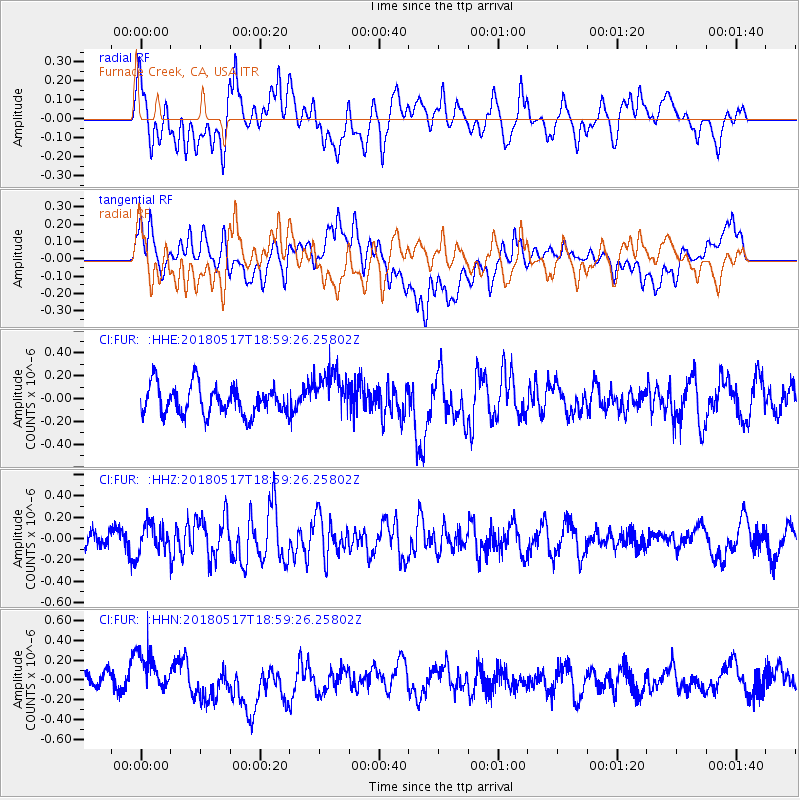
Signal To Noise
| Channel | StoN | STA | LTA |
| CI:FUR: :HHZ:20180517T18:59:26.25802Z | 1.3868316 | 1.360019E-7 | 9.806662E-8 |
| CI:FUR: :HHN:20180517T18:59:26.25802Z | 1.891566 | 1.9398371E-7 | 1.0255191E-7 |
| CI:FUR: :HHE:20180517T18:59:26.25802Z | 1.565037 | 2.0246624E-7 | 1.2936835E-7 |
| Arrivals |
| Ps | |
| PpPs | |
| PsPs/PpSs | |


