You are here: Home > Network List > CN - Canadian National Seismograph Network Stations List
> Station INK INUVIK, NT > Earthquake Result Viewer
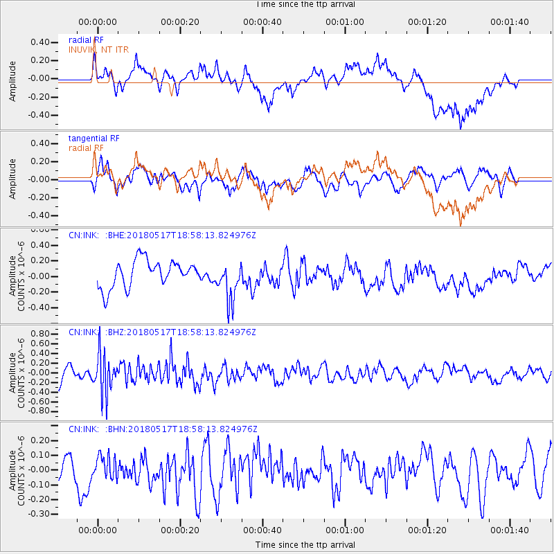
INK INUVIK, NT - Earthquake Result Viewer
*The percent match for this event was below the threshold and hence no stack was calculated.
| Earthquake location: |
South Of Mariana Islands |
| Earthquake latitude/longitude: |
13.0/145.3 |
| Earthquake time(UTC): |
2018/05/17 (137) 18:47:09 GMT |
| Earthquake Depth: |
37 km |
| Earthquake Magnitude: |
5.5 mb |
| Earthquake Catalog/Contributor: |
NEIC PDE/us |
|
| Network: |
CN Canadian National Seismograph Network |
| Station: |
INK INUVIK, NT |
| Lat/Lon: |
68.31 N/133.53 W |
| Elevation: |
44 m |
|
| Distance: |
74.7 deg |
| Az: |
22.382 deg |
| Baz: |
266.649 deg |
| Ray Param: |
$rayparam |
*The percent match for this event was below the threshold and hence was not used in the summary stack. |
|
| Radial Match: |
58.953194 % |
| Radial Bump: |
400 |
| Transverse Match: |
66.30646 % |
| Transverse Bump: |
400 |
| SOD ConfigId: |
13570011 |
| Insert Time: |
2019-04-30 06:44:23.277 +0000 |
| GWidth: |
2.5 |
| Max Bumps: |
400 |
| Tol: |
0.001 |
|
Signal To Noise
| Channel | StoN | STA | LTA |
| CN:INK: :BHZ:20180517T18:58:13.824976Z | 3.0558817 | 4.1237348E-7 | 1.3494419E-7 |
| CN:INK: :BHN:20180517T18:58:13.824976Z | 0.67289037 | 7.015457E-8 | 1.0425855E-7 |
| CN:INK: :BHE:20180517T18:58:13.824976Z | 1.5616804 | 2.6561065E-7 | 1.7008003E-7 |
| Arrivals |
| Ps | |
| PpPs | |
| PsPs/PpSs | |


