You are here: Home > Network List > AZ - ANZA Regional Network Stations List
> Station SMER AZ.SMER > Earthquake Result Viewer
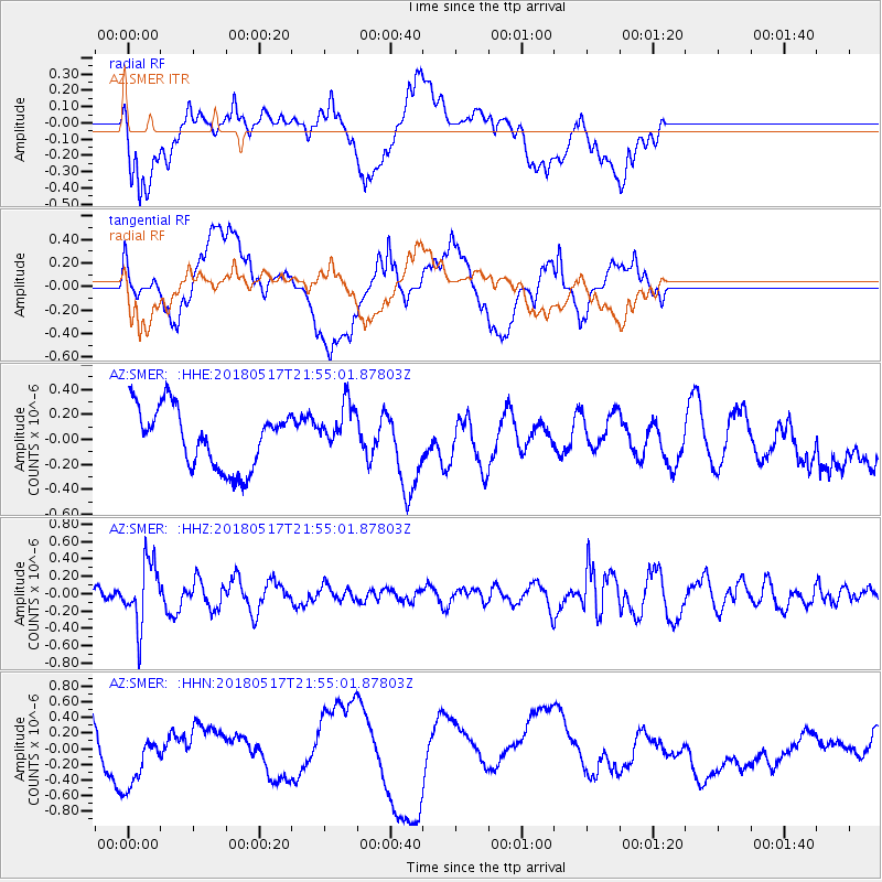
SMER AZ.SMER - Earthquake Result Viewer
*The percent match for this event was below the threshold and hence no stack was calculated.
| Earthquake location: |
South Of Kermadec Islands |
| Earthquake latitude/longitude: |
-32.1/-180.0 |
| Earthquake time(UTC): |
2018/05/17 (137) 21:43:10 GMT |
| Earthquake Depth: |
238 km |
| Earthquake Magnitude: |
5.7 mb |
| Earthquake Catalog/Contributor: |
NEIC PDE/us |
|
| Network: |
AZ ANZA Regional Network |
| Station: |
SMER AZ.SMER |
| Lat/Lon: |
33.46 N/117.17 W |
| Elevation: |
355 m |
|
| Distance: |
88.0 deg |
| Az: |
48.079 deg |
| Baz: |
229.077 deg |
| Ray Param: |
$rayparam |
*The percent match for this event was below the threshold and hence was not used in the summary stack. |
|
| Radial Match: |
28.14703 % |
| Radial Bump: |
400 |
| Transverse Match: |
31.94592 % |
| Transverse Bump: |
400 |
| SOD ConfigId: |
13570011 |
| Insert Time: |
2019-04-30 06:49:20.411 +0000 |
| GWidth: |
2.5 |
| Max Bumps: |
400 |
| Tol: |
0.001 |
|
Signal To Noise
| Channel | StoN | STA | LTA |
| AZ:SMER: :HHZ:20180517T21:55:01.87803Z | 3.7907531 | 3.5616256E-7 | 9.395562E-8 |
| AZ:SMER: :HHN:20180517T21:55:01.87803Z | 1.4461743 | 3.462749E-7 | 2.3944202E-7 |
| AZ:SMER: :HHE:20180517T21:55:01.87803Z | 0.8752321 | 2.042237E-7 | 2.3333662E-7 |
| Arrivals |
| Ps | |
| PpPs | |
| PsPs/PpSs | |


