You are here: Home > Network List > CI - Caltech Regional Seismic Network Stations List
> Station DAN Danby, California, USA > Earthquake Result Viewer
DAN Danby, California, USA - Earthquake Result Viewer
*The percent match for this event was below the threshold and hence no stack was calculated.
| Earthquake location: |
South Of Kermadec Islands |
| Earthquake latitude/longitude: |
-32.1/-180.0 |
| Earthquake time(UTC): |
2018/05/17 (137) 21:43:10 GMT |
| Earthquake Depth: |
238 km |
| Earthquake Magnitude: |
5.7 mb |
| Earthquake Catalog/Contributor: |
NEIC PDE/us |
|
| Network: |
CI Caltech Regional Seismic Network |
| Station: |
DAN Danby, California, USA |
| Lat/Lon: |
34.64 N/115.38 W |
| Elevation: |
398 m |
|
| Distance: |
89.9 deg |
| Az: |
48.148 deg |
| Baz: |
230.077 deg |
| Ray Param: |
$rayparam |
*The percent match for this event was below the threshold and hence was not used in the summary stack. |
|
| Radial Match: |
39.610596 % |
| Radial Bump: |
400 |
| Transverse Match: |
27.156801 % |
| Transverse Bump: |
400 |
| SOD ConfigId: |
13570011 |
| Insert Time: |
2019-04-30 06:50:05.779 +0000 |
| GWidth: |
2.5 |
| Max Bumps: |
400 |
| Tol: |
0.001 |
|
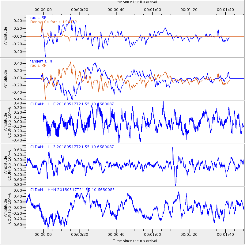
Signal To Noise
| Channel | StoN | STA | LTA |
| CI:DAN: :HHZ:20180517T21:55:10.668008Z | 2.1322286 | 2.5918325E-7 | 1.2155509E-7 |
| CI:DAN: :HHN:20180517T21:55:10.668008Z | 2.5440443 | 5.5943104E-7 | 2.1989833E-7 |
| CI:DAN: :HHE:20180517T21:55:10.668008Z | 1.7353568 | 2.302436E-7 | 1.3267795E-7 |
| Arrivals |
| Ps | |
| PpPs | |
| PsPs/PpSs | |


