You are here: Home > Network List > UW - Pacific Northwest Regional Seismic Network Stations List
> Station LEBA Lebam, WA, USA > Earthquake Result Viewer
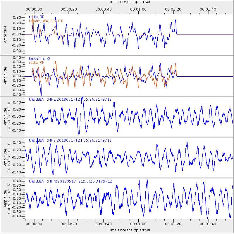
LEBA Lebam, WA, USA - Earthquake Result Viewer
*The percent match for this event was below the threshold and hence no stack was calculated.
| Earthquake location: |
South Of Kermadec Islands |
| Earthquake latitude/longitude: |
-32.1/-180.0 |
| Earthquake time(UTC): |
2018/05/17 (137) 21:43:10 GMT |
| Earthquake Depth: |
238 km |
| Earthquake Magnitude: |
5.7 mb |
| Earthquake Catalog/Contributor: |
NEIC PDE/us |
|
| Network: |
UW Pacific Northwest Regional Seismic Network |
| Station: |
LEBA Lebam, WA, USA |
| Lat/Lon: |
46.55 N/123.56 W |
| Elevation: |
73 m |
|
| Distance: |
93.3 deg |
| Az: |
35.17 deg |
| Baz: |
225.111 deg |
| Ray Param: |
$rayparam |
*The percent match for this event was below the threshold and hence was not used in the summary stack. |
|
| Radial Match: |
57.75423 % |
| Radial Bump: |
400 |
| Transverse Match: |
40.659004 % |
| Transverse Bump: |
383 |
| SOD ConfigId: |
13570011 |
| Insert Time: |
2019-04-30 06:52:49.313 +0000 |
| GWidth: |
2.5 |
| Max Bumps: |
400 |
| Tol: |
0.001 |
|
Signal To Noise
| Channel | StoN | STA | LTA |
| UW:LEBA: :HHZ:20180517T21:55:26.317971Z | 2.7489305 | 2.7188784E-7 | 9.890677E-8 |
| UW:LEBA: :HHN:20180517T21:55:26.317971Z | 0.9551923 | 9.915174E-8 | 1.03802904E-7 |
| UW:LEBA: :HHE:20180517T21:55:26.317971Z | 1.4567902 | 1.964289E-7 | 1.3483678E-7 |
| Arrivals |
| Ps | |
| PpPs | |
| PsPs/PpSs | |


