You are here: Home > Network List > UW - Pacific Northwest Regional Seismic Network Stations List
> Station LTY Liberty (broad-band) > Earthquake Result Viewer
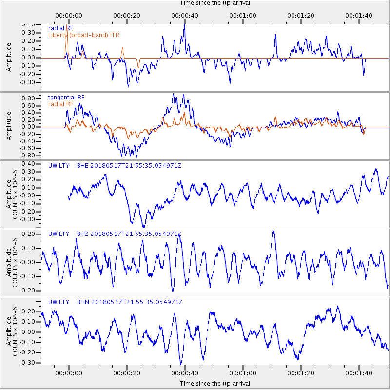
LTY Liberty (broad-band) - Earthquake Result Viewer
*The percent match for this event was below the threshold and hence no stack was calculated.
| Earthquake location: |
South Of Kermadec Islands |
| Earthquake latitude/longitude: |
-32.1/-180.0 |
| Earthquake time(UTC): |
2018/05/17 (137) 21:43:10 GMT |
| Earthquake Depth: |
238 km |
| Earthquake Magnitude: |
5.7 mb |
| Earthquake Catalog/Contributor: |
NEIC PDE/us |
|
| Network: |
UW Pacific Northwest Regional Seismic Network |
| Station: |
LTY Liberty (broad-band) |
| Lat/Lon: |
47.26 N/120.66 W |
| Elevation: |
970 m |
|
| Distance: |
95.3 deg |
| Az: |
36.038 deg |
| Baz: |
227.156 deg |
| Ray Param: |
$rayparam |
*The percent match for this event was below the threshold and hence was not used in the summary stack. |
|
| Radial Match: |
53.234737 % |
| Radial Bump: |
400 |
| Transverse Match: |
53.15718 % |
| Transverse Bump: |
400 |
| SOD ConfigId: |
13570011 |
| Insert Time: |
2019-04-30 06:52:49.707 +0000 |
| GWidth: |
2.5 |
| Max Bumps: |
400 |
| Tol: |
0.001 |
|
Signal To Noise
| Channel | StoN | STA | LTA |
| UW:LTY: :BHZ:20180517T21:55:35.054971Z | 1.108452 | 6.70989E-8 | 6.0533885E-8 |
| UW:LTY: :BHN:20180517T21:55:35.054971Z | 1.0642767 | 9.6174126E-8 | 9.036572E-8 |
| UW:LTY: :BHE:20180517T21:55:35.054971Z | 0.99793494 | 1.4730134E-7 | 1.4760614E-7 |
| Arrivals |
| Ps | |
| PpPs | |
| PsPs/PpSs | |


