You are here: Home > Network List > US - United States National Seismic Network Stations List
> Station DGMT Dagmar, Montana, USA > Earthquake Result Viewer
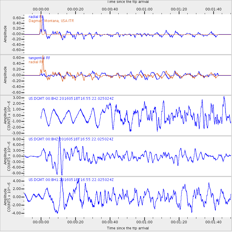
DGMT Dagmar, Montana, USA - Earthquake Result Viewer
*The percent match for this event was below the threshold and hence no stack was calculated.
| Earthquake location: |
Near Coast Of Ecuador |
| Earthquake latitude/longitude: |
0.5/-79.6 |
| Earthquake time(UTC): |
2016/05/18 (139) 16:46:44 GMT |
| Earthquake Depth: |
31 km |
| Earthquake Magnitude: |
6.8 MO |
| Earthquake Catalog/Contributor: |
NEIC PDE/NEIC ALERT |
|
| Network: |
US United States National Seismic Network |
| Station: |
DGMT Dagmar, Montana, USA |
| Lat/Lon: |
48.47 N/104.20 W |
| Elevation: |
0.0 m |
|
| Distance: |
52.3 deg |
| Az: |
339.546 deg |
| Baz: |
148.326 deg |
| Ray Param: |
$rayparam |
*The percent match for this event was below the threshold and hence was not used in the summary stack. |
|
| Radial Match: |
81.43492 % |
| Radial Bump: |
375 |
| Transverse Match: |
63.260468 % |
| Transverse Bump: |
400 |
| SOD ConfigId: |
1475611 |
| Insert Time: |
2016-06-01 16:57:56.229 +0000 |
| GWidth: |
2.5 |
| Max Bumps: |
400 |
| Tol: |
0.001 |
|
Signal To Noise
| Channel | StoN | STA | LTA |
| US:DGMT:00:BHZ:20160518T16:55:22.025024Z | 8.975188 | 2.133735E-6 | 2.3773707E-7 |
| US:DGMT:00:BH1:20160518T16:55:22.025024Z | 1.7883031 | 1.200377E-6 | 6.71238E-7 |
| US:DGMT:00:BH2:20160518T16:55:22.025024Z | 1.5212445 | 1.1933431E-6 | 7.8445186E-7 |
| Arrivals |
| Ps | |
| PpPs | |
| PsPs/PpSs | |


