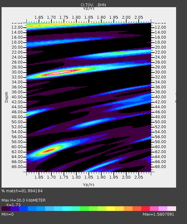
TOV Thousand Oaks, California, USA - Earthquake Result Viewer
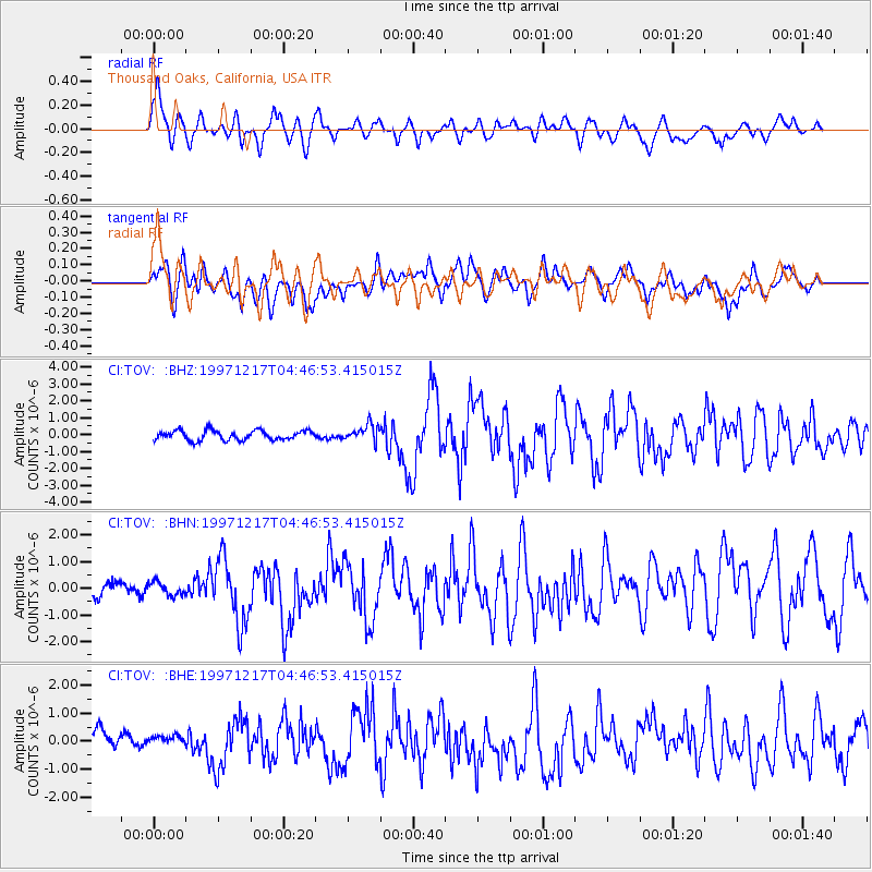
Earthquake location: Rat Islands, Aleutian Islands
Earthquake latitude/longitude: 51.2/178.9
Earthquake time(UTC): 1997/12/17 (351) 04:38:51 GMT
Earthquake Depth: 20 km
Earthquake Magnitude: 5.8 MB, 6.5 MS, 6.7 UNKNOWN, 6.1 ME
Earthquake Catalog/Contributor: WHDF/NEIC
Network: CI Caltech Regional Seismic Network
Station: TOV Thousand Oaks, California, USA
Lat/Lon: 34.16 N/118.82 W
Elevation: 50 m
Distance: 47.4 deg
Az: 85.93 deg
Baz: 310.8 deg
Ray Param: 0.06998575
Estimated Moho Depth: 30.0 km
Estimated Crust Vp/Vs: 1.73
Assumed Crust Vp: 6.1 km/s
Estimated Crust Vs: 3.526 km/s
Estimated Crust Poisson's Ratio: 0.25
Radial Match: 81.994194 %
Radial Bump: 400
Transverse Match: 74.15126 %
Transverse Bump: 400
SOD ConfigId: 3787
Insert Time: 2010-02-26 01:58:26.378 +0000
GWidth: 2.5
Max Bumps: 400
Tol: 0.001

Signal To Noise

ChannelStoNSTALTA
CI:TOV: :BHN:19971217T04:46:53.415015Z0.910717843.580217E-73.9312033E-7
CI:TOV: :BHE:19971217T04:46:53.415015Z0.729746462.8551736E-73.9125558E-7
CI:TOV: :BHZ:19971217T04:46:53.415015Z1.71881484.8592125E-72.8270716E-7
Arrivals
Ps3.8 SECOND
PpPs13 SECOND
PsPs/PpSs16 SECOND