N23A Red Feather Lakes, CO, USA - Earthquake Result Viewer
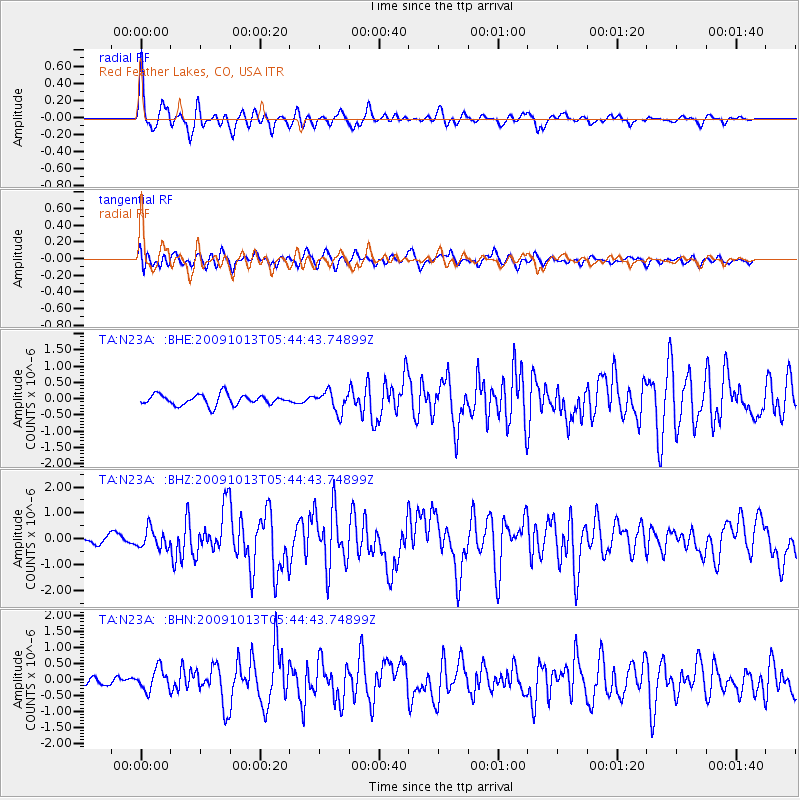
Earthquake location: Fox Islands, Aleutian Islands
Earthquake latitude/longitude: 52.8/-167.0
Earthquake time(UTC): 2009/10/13 (286) 05:37:23 GMT
Earthquake Depth: 24 km
Earthquake Magnitude: 6.0 MB, 6.1 MS, 6.5 MW, 6.5 MW
Earthquake Catalog/Contributor: WHDF/NEIC
Network: TA USArray Transportable Network (new EarthScope stations)
Station: N23A Red Feather Lakes, CO, USA
Lat/Lon: 40.89 N/105.94 W
Elevation: 2458 m
Distance: 42.2 deg
Az: 81.003 deg
Baz: 307.636 deg
Ray Param: 0.073279455
Estimated Moho Depth: 21.0 km
Estimated Crust Vp/Vs: 2.07
Assumed Crust Vp: 6.306 km/s
Estimated Crust Vs: 3.054 km/s
Estimated Crust Poisson's Ratio: 0.35
Radial Match: 86.89724 %
Radial Bump: 400
Transverse Match: 72.162544 %
Transverse Bump: 400
SOD ConfigId: 2622
Insert Time: 2010-03-06 11:19:03.467 +0000
GWidth: 2.5
Max Bumps: 400
Tol: 0.001

Signal To Noise

ChannelStoNSTALTA
TA:N23A: :BHZ:20091013T05:44:43.74899Z2.2223713.6359182E-71.6360536E-7
TA:N23A: :BHN:20091013T05:44:43.74899Z2.78070783.3887574E-71.2186672E-7
TA:N23A: :BHE:20091013T05:44:43.74899Z1.94606353.177334E-71.6326979E-7
Arrivals
Ps3.7 SECOND
PpPs9.7 SECOND
PsPs/PpSs13 SECOND