You are here: Home > Network List > CI - Caltech Regional Seismic Network Stations List
> Station MPM Manuel Prospect Mine, California, USA > Earthquake Result Viewer
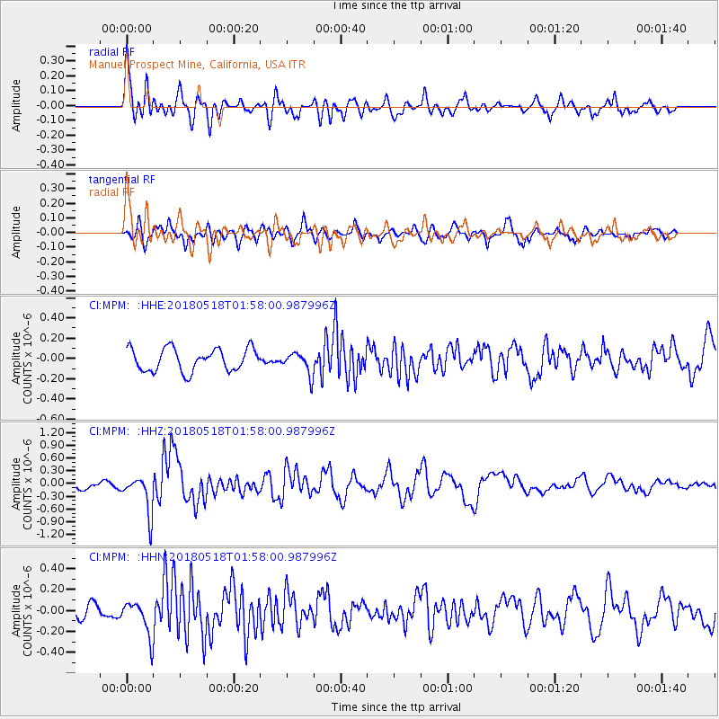
MPM Manuel Prospect Mine, California, USA - Earthquake Result Viewer
*The percent match for this event was below the threshold and hence no stack was calculated.
| Earthquake location: |
South Of Kermadec Islands |
| Earthquake latitude/longitude: |
-34.6/-178.4 |
| Earthquake time(UTC): |
2018/05/18 (138) 01:45:31 GMT |
| Earthquake Depth: |
11 km |
| Earthquake Magnitude: |
6.2 Mww |
| Earthquake Catalog/Contributor: |
NEIC PDE/us |
|
| Network: |
CI Caltech Regional Seismic Network |
| Station: |
MPM Manuel Prospect Mine, California, USA |
| Lat/Lon: |
36.06 N/117.49 W |
| Elevation: |
185 m |
|
| Distance: |
90.3 deg |
| Az: |
45.09 deg |
| Baz: |
226.171 deg |
| Ray Param: |
$rayparam |
*The percent match for this event was below the threshold and hence was not used in the summary stack. |
|
| Radial Match: |
78.42657 % |
| Radial Bump: |
400 |
| Transverse Match: |
62.221966 % |
| Transverse Bump: |
400 |
| SOD ConfigId: |
13570011 |
| Insert Time: |
2019-04-30 06:56:03.081 +0000 |
| GWidth: |
2.5 |
| Max Bumps: |
400 |
| Tol: |
0.001 |
|
Signal To Noise
| Channel | StoN | STA | LTA |
| CI:MPM: :HHZ:20180518T01:58:00.987996Z | 4.249856 | 4.4965512E-7 | 1.05804794E-7 |
| CI:MPM: :HHN:20180518T01:58:00.987996Z | 2.1524127 | 1.7158851E-7 | 7.971915E-8 |
| CI:MPM: :HHE:20180518T01:58:00.987996Z | 0.9792273 | 1.0871609E-7 | 1.1102232E-7 |
| Arrivals |
| Ps | |
| PpPs | |
| PsPs/PpSs | |


