You are here: Home > Network List > CI - Caltech Regional Seismic Network Stations List
> Station SMM Simmler, CA, USA > Earthquake Result Viewer
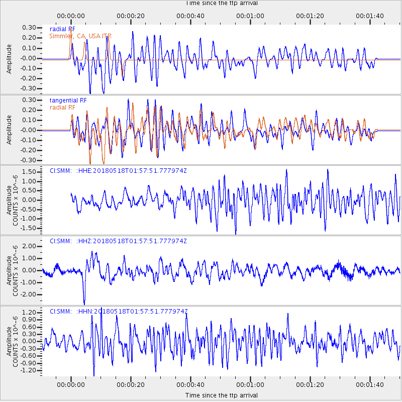
SMM Simmler, CA, USA - Earthquake Result Viewer
*The percent match for this event was below the threshold and hence no stack was calculated.
| Earthquake location: |
South Of Kermadec Islands |
| Earthquake latitude/longitude: |
-34.6/-178.4 |
| Earthquake time(UTC): |
2018/05/18 (138) 01:45:31 GMT |
| Earthquake Depth: |
11 km |
| Earthquake Magnitude: |
6.2 Mww |
| Earthquake Catalog/Contributor: |
NEIC PDE/us |
|
| Network: |
CI Caltech Regional Seismic Network |
| Station: |
SMM Simmler, CA, USA |
| Lat/Lon: |
35.31 N/120.00 W |
| Elevation: |
599 m |
|
| Distance: |
88.4 deg |
| Az: |
44.187 deg |
| Baz: |
224.705 deg |
| Ray Param: |
$rayparam |
*The percent match for this event was below the threshold and hence was not used in the summary stack. |
|
| Radial Match: |
61.66914 % |
| Radial Bump: |
400 |
| Transverse Match: |
65.35642 % |
| Transverse Bump: |
400 |
| SOD ConfigId: |
13570011 |
| Insert Time: |
2019-04-30 06:56:13.838 +0000 |
| GWidth: |
2.5 |
| Max Bumps: |
400 |
| Tol: |
0.001 |
|
Signal To Noise
| Channel | StoN | STA | LTA |
| CI:SMM: :HHZ:20180518T01:57:51.777974Z | 3.8310137 | 8.5052517E-7 | 2.2201047E-7 |
| CI:SMM: :HHN:20180518T01:57:51.777974Z | 0.9768 | 2.6050017E-7 | 2.6668732E-7 |
| CI:SMM: :HHE:20180518T01:57:51.777974Z | 1.258894 | 3.4837163E-7 | 2.7672831E-7 |
| Arrivals |
| Ps | |
| PpPs | |
| PsPs/PpSs | |


