N23A Red Feather Lakes, CO, USA - Earthquake Result Viewer
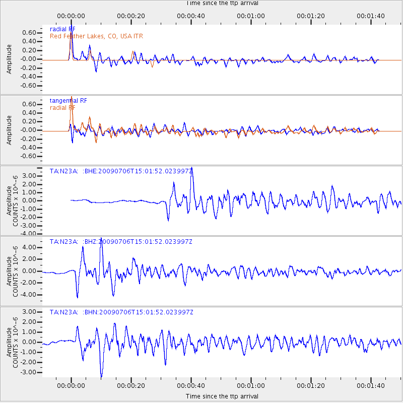
Earthquake location: Rat Islands, Aleutian Islands
Earthquake latitude/longitude: 50.4/177.0
Earthquake time(UTC): 2009/07/06 (187) 14:53:12 GMT
Earthquake Depth: 22 km
Earthquake Magnitude: 6.0 MB, 5.8 MS, 6.1 MW, 6.0 MW
Earthquake Catalog/Contributor: WHDF/NEIC
Network: TA USArray Transportable Network (new EarthScope stations)
Station: N23A Red Feather Lakes, CO, USA
Lat/Lon: 40.89 N/105.94 W
Elevation: 2458 m
Distance: 52.4 deg
Az: 68.8 deg
Baz: 308.143 deg
Ray Param: 0.066742636
Estimated Moho Depth: 59.75 km
Estimated Crust Vp/Vs: 1.62
Assumed Crust Vp: 6.306 km/s
Estimated Crust Vs: 3.899 km/s
Estimated Crust Poisson's Ratio: 0.19
Radial Match: 91.89962 %
Radial Bump: 400
Transverse Match: 79.29589 %
Transverse Bump: 400
SOD ConfigId: 2648
Insert Time: 2010-03-06 11:19:33.771 +0000
GWidth: 2.5
Max Bumps: 400
Tol: 0.001

Signal To Noise

ChannelStoNSTALTA
TA:N23A: :BHZ:20090706T15:01:52.023997Z15.5449071.983022E-61.2756732E-7
TA:N23A: :BHN:20090706T15:01:52.023997Z8.8527197.9844364E-79.019191E-8
TA:N23A: :BHE:20090706T15:01:52.023997Z9.1665451.0304047E-61.12409275E-7
Arrivals
Ps6.2 SECOND
PpPs23 SECOND
PsPs/PpSs30 SECOND