You are here: Home > Network List > UW - Pacific Northwest Regional Seismic Network Stations List
> Station UMAT Pilot Rock, OR, USA > Earthquake Result Viewer
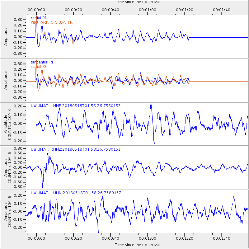
UMAT Pilot Rock, OR, USA - Earthquake Result Viewer
*The percent match for this event was below the threshold and hence no stack was calculated.
| Earthquake location: |
South Of Kermadec Islands |
| Earthquake latitude/longitude: |
-34.6/-178.4 |
| Earthquake time(UTC): |
2018/05/18 (138) 01:45:31 GMT |
| Earthquake Depth: |
11 km |
| Earthquake Magnitude: |
6.2 Mww |
| Earthquake Catalog/Contributor: |
NEIC PDE/us |
|
| Network: |
UW Pacific Northwest Regional Seismic Network |
| Station: |
UMAT Pilot Rock, OR, USA |
| Lat/Lon: |
45.29 N/118.96 W |
| Elevation: |
1318 m |
|
| Distance: |
96.0 deg |
| Az: |
37.68 deg |
| Baz: |
225.621 deg |
| Ray Param: |
$rayparam |
*The percent match for this event was below the threshold and hence was not used in the summary stack. |
|
| Radial Match: |
60.594467 % |
| Radial Bump: |
395 |
| Transverse Match: |
47.024868 % |
| Transverse Bump: |
377 |
| SOD ConfigId: |
13570011 |
| Insert Time: |
2019-04-30 06:59:19.019 +0000 |
| GWidth: |
2.5 |
| Max Bumps: |
400 |
| Tol: |
0.001 |
|
Signal To Noise
| Channel | StoN | STA | LTA |
| UW:UMAT: :HHZ:20180518T01:58:26.758015Z | 3.401063 | 2.7168133E-7 | 7.98813E-8 |
| UW:UMAT: :HHN:20180518T01:58:26.758015Z | 1.1741108 | 6.509811E-8 | 5.5444602E-8 |
| UW:UMAT: :HHE:20180518T01:58:26.758015Z | 0.87599236 | 5.8410258E-8 | 6.667896E-8 |
| Arrivals |
| Ps | |
| PpPs | |
| PsPs/PpSs | |


