You are here: Home > Network List > TA - USArray Transportable Network (new EarthScope stations) Stations List
> Station N23A Red Feather Lakes, CO, USA > Earthquake Result Viewer
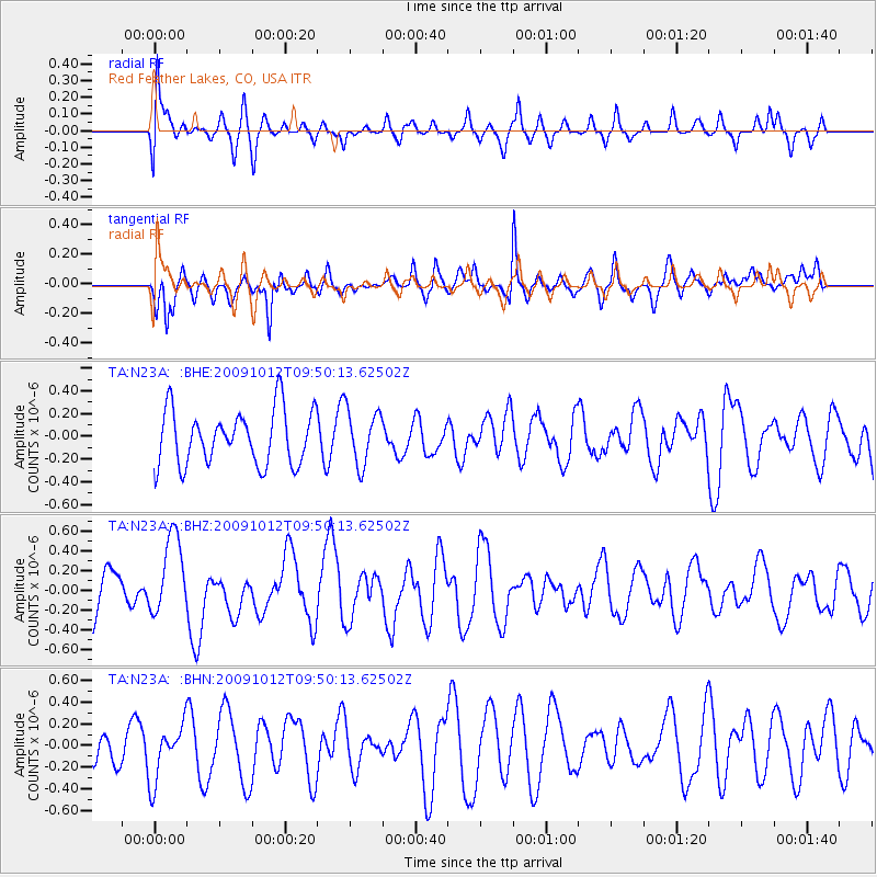
N23A Red Feather Lakes, CO, USA - Earthquake Result Viewer
*The percent match for this event was below the threshold and hence no stack was calculated.
| Earthquake location: |
Santa Cruz Islands |
| Earthquake latitude/longitude: |
-12.4/166.5 |
| Earthquake time(UTC): |
2009/10/12 (285) 09:37:21 GMT |
| Earthquake Depth: |
42 km |
| Earthquake Magnitude: |
5.9 MB, 5.9 MS, 6.2 MW, 6.2 MW |
| Earthquake Catalog/Contributor: |
WHDF/NEIC |
|
| Network: |
TA USArray Transportable Network (new EarthScope stations) |
| Station: |
N23A Red Feather Lakes, CO, USA |
| Lat/Lon: |
40.89 N/105.94 W |
| Elevation: |
2458 m |
|
| Distance: |
96.2 deg |
| Az: |
49.626 deg |
| Baz: |
259.037 deg |
| Ray Param: |
$rayparam |
*The percent match for this event was below the threshold and hence was not used in the summary stack. |
|
| Radial Match: |
43.9404 % |
| Radial Bump: |
400 |
| Transverse Match: |
56.744984 % |
| Transverse Bump: |
366 |
| SOD ConfigId: |
2622 |
| Insert Time: |
2010-03-06 11:20:25.328 +0000 |
| GWidth: |
2.5 |
| Max Bumps: |
400 |
| Tol: |
0.001 |
|
Signal To Noise
| Channel | StoN | STA | LTA |
| TA:N23A: :BHZ:20091012T09:50:13.62502Z | 2.064608 | 4.01991E-7 | 1.947057E-7 |
| TA:N23A: :BHN:20091012T09:50:13.62502Z | 1.3081921 | 2.6039805E-7 | 1.9905184E-7 |
| TA:N23A: :BHE:20091012T09:50:13.62502Z | 1.0115505 | 2.418959E-7 | 2.3913378E-7 |
| Arrivals |
| Ps | |
| PpPs | |
| PsPs/PpSs | |


