You are here: Home > Network List > TA - USArray Transportable Network (new EarthScope stations) Stations List
> Station F20K Avaraart Lake, AK, USA > Earthquake Result Viewer
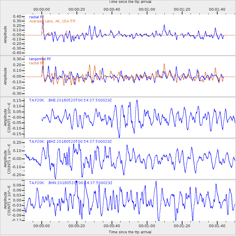
F20K Avaraart Lake, AK, USA - Earthquake Result Viewer
*The percent match for this event was below the threshold and hence no stack was calculated.
| Earthquake location: |
Tonga Islands |
| Earthquake latitude/longitude: |
-21.0/-174.0 |
| Earthquake time(UTC): |
2018/05/20 (140) 00:42:14 GMT |
| Earthquake Depth: |
10 km |
| Earthquake Magnitude: |
5.5 Mww |
| Earthquake Catalog/Contributor: |
NEIC PDE/us |
|
| Network: |
TA USArray Transportable Network (new EarthScope stations) |
| Station: |
F20K Avaraart Lake, AK, USA |
| Lat/Lon: |
67.05 N/155.73 W |
| Elevation: |
136 m |
|
| Distance: |
88.8 deg |
| Az: |
7.066 deg |
| Baz: |
197.046 deg |
| Ray Param: |
$rayparam |
*The percent match for this event was below the threshold and hence was not used in the summary stack. |
|
| Radial Match: |
49.442905 % |
| Radial Bump: |
400 |
| Transverse Match: |
47.179718 % |
| Transverse Bump: |
400 |
| SOD ConfigId: |
13570011 |
| Insert Time: |
2019-04-30 07:05:44.513 +0000 |
| GWidth: |
2.5 |
| Max Bumps: |
400 |
| Tol: |
0.001 |
|
Signal To Noise
| Channel | StoN | STA | LTA |
| TA:F20K: :BHZ:20180520T00:54:37.500029Z | 2.1826217 | 9.963154E-8 | 4.5647646E-8 |
| TA:F20K: :BHN:20180520T00:54:37.500029Z | 0.5459594 | 2.2785672E-8 | 4.1735102E-8 |
| TA:F20K: :BHE:20180520T00:54:37.500029Z | 1.0992372 | 4.676608E-8 | 4.254412E-8 |
| Arrivals |
| Ps | |
| PpPs | |
| PsPs/PpSs | |


