You are here: Home > Network List > TA - USArray Transportable Network (new EarthScope stations) Stations List
> Station G16K Koyuk River, AK, USA > Earthquake Result Viewer
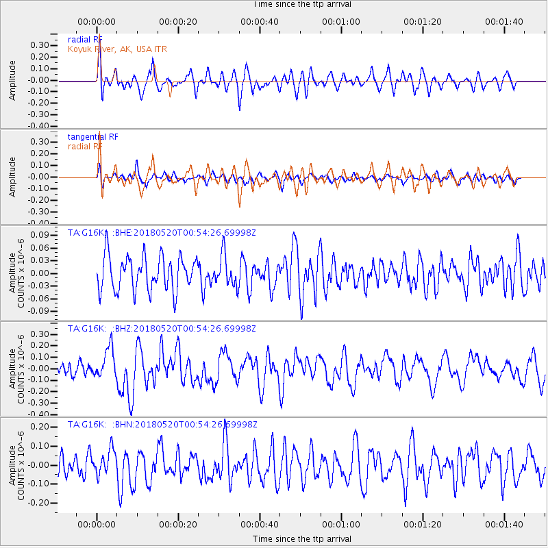
G16K Koyuk River, AK, USA - Earthquake Result Viewer
*The percent match for this event was below the threshold and hence no stack was calculated.
| Earthquake location: |
Tonga Islands |
| Earthquake latitude/longitude: |
-21.0/-174.0 |
| Earthquake time(UTC): |
2018/05/20 (140) 00:42:14 GMT |
| Earthquake Depth: |
10 km |
| Earthquake Magnitude: |
5.5 Mww |
| Earthquake Catalog/Contributor: |
NEIC PDE/us |
|
| Network: |
TA USArray Transportable Network (new EarthScope stations) |
| Station: |
G16K Koyuk River, AK, USA |
| Lat/Lon: |
65.39 N/162.35 W |
| Elevation: |
169 m |
|
| Distance: |
86.6 deg |
| Az: |
4.858 deg |
| Baz: |
190.895 deg |
| Ray Param: |
$rayparam |
*The percent match for this event was below the threshold and hence was not used in the summary stack. |
|
| Radial Match: |
59.046627 % |
| Radial Bump: |
400 |
| Transverse Match: |
59.405655 % |
| Transverse Bump: |
400 |
| SOD ConfigId: |
13570011 |
| Insert Time: |
2019-04-30 07:05:49.753 +0000 |
| GWidth: |
2.5 |
| Max Bumps: |
400 |
| Tol: |
0.001 |
|
Signal To Noise
| Channel | StoN | STA | LTA |
| TA:G16K: :BHZ:20180520T00:54:26.69998Z | 1.8451821 | 1.3949919E-7 | 7.560186E-8 |
| TA:G16K: :BHN:20180520T00:54:26.69998Z | 1.103709 | 6.8595284E-8 | 6.2149795E-8 |
| TA:G16K: :BHE:20180520T00:54:26.69998Z | 0.8648044 | 3.507309E-8 | 4.0556095E-8 |
| Arrivals |
| Ps | |
| PpPs | |
| PsPs/PpSs | |


