You are here: Home > Network List > CN - Canadian National Seismograph Network Stations List
> Station INK INUVIK, NT > Earthquake Result Viewer
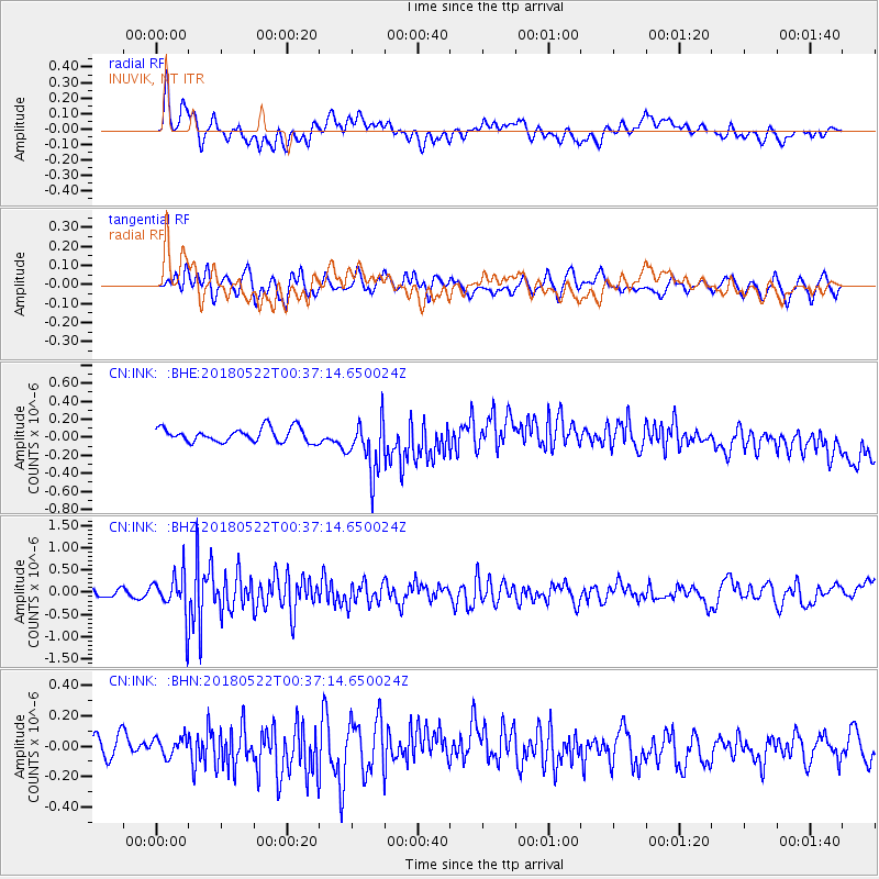
INK INUVIK, NT - Earthquake Result Viewer
*The percent match for this event was below the threshold and hence no stack was calculated.
| Earthquake location: |
South Of Mariana Islands |
| Earthquake latitude/longitude: |
12.8/145.8 |
| Earthquake time(UTC): |
2018/05/22 (142) 00:26:04 GMT |
| Earthquake Depth: |
10 km |
| Earthquake Magnitude: |
6.0 Mi |
| Earthquake Catalog/Contributor: |
NEIC PDE/pt |
|
| Network: |
CN Canadian National Seismograph Network |
| Station: |
INK INUVIK, NT |
| Lat/Lon: |
68.31 N/133.53 W |
| Elevation: |
44 m |
|
| Distance: |
74.8 deg |
| Az: |
22.348 deg |
| Baz: |
266.171 deg |
| Ray Param: |
$rayparam |
*The percent match for this event was below the threshold and hence was not used in the summary stack. |
|
| Radial Match: |
34.951797 % |
| Radial Bump: |
400 |
| Transverse Match: |
61.463802 % |
| Transverse Bump: |
400 |
| SOD ConfigId: |
13570011 |
| Insert Time: |
2019-04-30 07:14:11.317 +0000 |
| GWidth: |
2.5 |
| Max Bumps: |
400 |
| Tol: |
0.001 |
|
Signal To Noise
| Channel | StoN | STA | LTA |
| CN:INK: :BHZ:20180522T00:37:14.650024Z | 7.8359923 | 4.7900255E-7 | 6.112851E-8 |
| CN:INK: :BHN:20180522T00:37:14.650024Z | 0.5890858 | 5.961517E-8 | 1.0119947E-7 |
| CN:INK: :BHE:20180522T00:37:14.650024Z | 3.2709794 | 2.4584793E-7 | 7.516034E-8 |
| Arrivals |
| Ps | |
| PpPs | |
| PsPs/PpSs | |


