You are here: Home > Network List > TA - USArray Transportable Network (new EarthScope stations) Stations List
> Station B18K Kokolik River, AK, USA > Earthquake Result Viewer
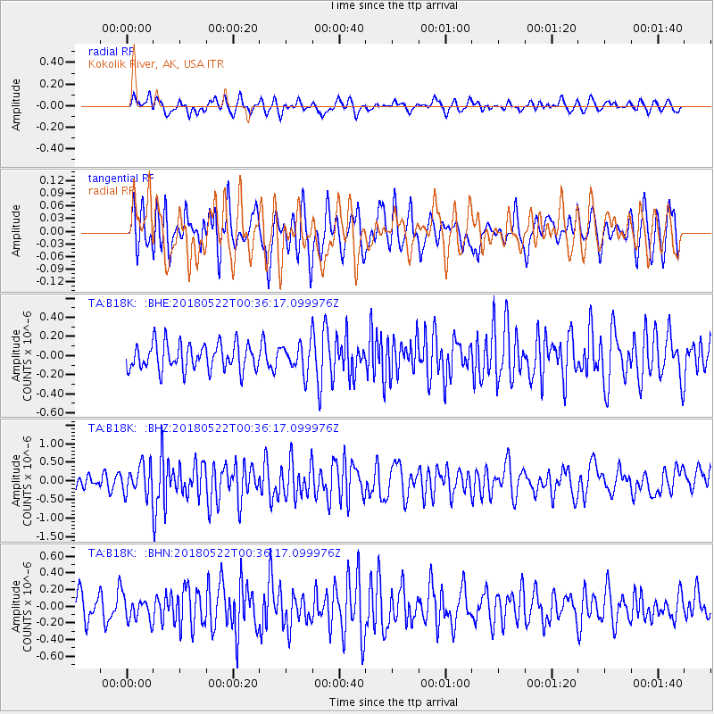
B18K Kokolik River, AK, USA - Earthquake Result Viewer
*The percent match for this event was below the threshold and hence no stack was calculated.
| Earthquake location: |
South Of Mariana Islands |
| Earthquake latitude/longitude: |
12.8/145.8 |
| Earthquake time(UTC): |
2018/05/22 (142) 00:26:04 GMT |
| Earthquake Depth: |
10 km |
| Earthquake Magnitude: |
6.0 Mi |
| Earthquake Catalog/Contributor: |
NEIC PDE/pt |
|
| Network: |
TA USArray Transportable Network (new EarthScope stations) |
| Station: |
B18K Kokolik River, AK, USA |
| Lat/Lon: |
69.36 N/161.80 W |
| Elevation: |
222 m |
|
| Distance: |
65.4 deg |
| Az: |
18.002 deg |
| Baz: |
238.27 deg |
| Ray Param: |
$rayparam |
*The percent match for this event was below the threshold and hence was not used in the summary stack. |
|
| Radial Match: |
60.123753 % |
| Radial Bump: |
400 |
| Transverse Match: |
56.65683 % |
| Transverse Bump: |
400 |
| SOD ConfigId: |
13570011 |
| Insert Time: |
2019-04-30 07:16:20.208 +0000 |
| GWidth: |
2.5 |
| Max Bumps: |
400 |
| Tol: |
0.001 |
|
Signal To Noise
| Channel | StoN | STA | LTA |
| TA:B18K: :BHZ:20180522T00:36:17.099976Z | 1.7224627 | 3.905864E-7 | 2.2676045E-7 |
| TA:B18K: :BHN:20180522T00:36:17.099976Z | 0.9436845 | 1.3760393E-7 | 1.4581562E-7 |
| TA:B18K: :BHE:20180522T00:36:17.099976Z | 0.770597 | 1.07748804E-7 | 1.398251E-7 |
| Arrivals |
| Ps | |
| PpPs | |
| PsPs/PpSs | |


