You are here: Home > Network List > TA - USArray Transportable Network (new EarthScope stations) Stations List
> Station E20K Nigu River, AK, USA > Earthquake Result Viewer
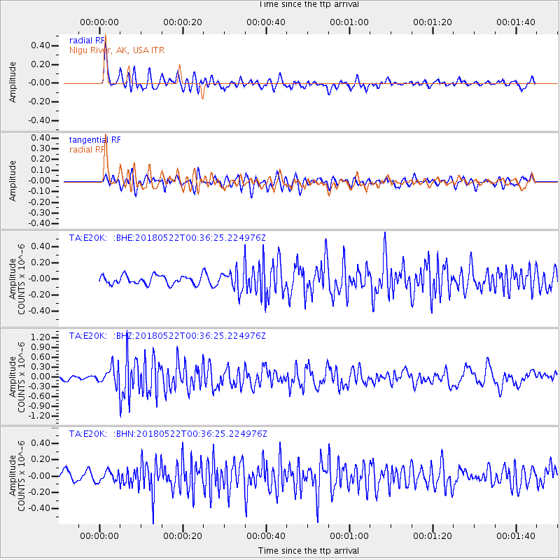
E20K Nigu River, AK, USA - Earthquake Result Viewer
*The percent match for this event was below the threshold and hence no stack was calculated.
| Earthquake location: |
South Of Mariana Islands |
| Earthquake latitude/longitude: |
12.8/145.8 |
| Earthquake time(UTC): |
2018/05/22 (142) 00:26:04 GMT |
| Earthquake Depth: |
10 km |
| Earthquake Magnitude: |
6.0 Mi |
| Earthquake Catalog/Contributor: |
NEIC PDE/pt |
|
| Network: |
TA USArray Transportable Network (new EarthScope stations) |
| Station: |
E20K Nigu River, AK, USA |
| Lat/Lon: |
68.26 N/156.19 W |
| Elevation: |
866 m |
|
| Distance: |
66.7 deg |
| Az: |
20.14 deg |
| Baz: |
244.368 deg |
| Ray Param: |
$rayparam |
*The percent match for this event was below the threshold and hence was not used in the summary stack. |
|
| Radial Match: |
67.5522 % |
| Radial Bump: |
400 |
| Transverse Match: |
74.22136 % |
| Transverse Bump: |
400 |
| SOD ConfigId: |
13570011 |
| Insert Time: |
2019-04-30 07:16:55.011 +0000 |
| GWidth: |
2.5 |
| Max Bumps: |
400 |
| Tol: |
0.001 |
|
Signal To Noise
| Channel | StoN | STA | LTA |
| TA:E20K: :BHZ:20180522T00:36:25.224976Z | 3.6912317 | 2.713491E-7 | 7.3511806E-8 |
| TA:E20K: :BHN:20180522T00:36:25.224976Z | 0.8664876 | 6.4118765E-8 | 7.399848E-8 |
| TA:E20K: :BHE:20180522T00:36:25.224976Z | 1.6731291 | 8.5788216E-8 | 5.1274117E-8 |
| Arrivals |
| Ps | |
| PpPs | |
| PsPs/PpSs | |


