L23A Garrett, WY, USA - Earthquake Result Viewer
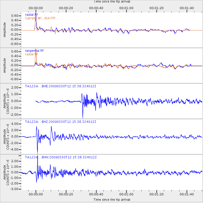
Earthquake location: Andreanof Islands, Aleutian Is.
Earthquake latitude/longitude: 51.5/-178.3
Earthquake time(UTC): 2009/03/30 (089) 12:07:28 GMT
Earthquake Depth: 31 km
Earthquake Magnitude: 6.0 MB, 5.5 MS, 5.7 MW, 5.7 MW
Earthquake Catalog/Contributor: WHDF/NEIC
Network: TA USArray Transportable Network (new EarthScope stations)
Station: L23A Garrett, WY, USA
Lat/Lon: 42.11 N/105.70 W
Elevation: 2153 m
Distance: 48.6 deg
Az: 71.092 deg
Baz: 307.423 deg
Ray Param: 0.06918207
Estimated Moho Depth: 31.5 km
Estimated Crust Vp/Vs: 1.85
Assumed Crust Vp: 6.159 km/s
Estimated Crust Vs: 3.334 km/s
Estimated Crust Poisson's Ratio: 0.29
Radial Match: 87.749435 %
Radial Bump: 400
Transverse Match: 70.24255 %
Transverse Bump: 400
SOD ConfigId: 2658
Insert Time: 2010-03-06 11:22:52.485 +0000
GWidth: 2.5
Max Bumps: 400
Tol: 0.001

Signal To Noise

ChannelStoNSTALTA
TA:L23A: :BHZ:20090330T12:15:38.324012Z16.4004941.5332148E-69.3485895E-8
TA:L23A: :BHN:20090330T12:15:38.324012Z7.946878.2432877E-71.03729995E-7
TA:L23A: :BHE:20090330T12:15:38.324012Z9.8877396.956456E-77.035436E-8
Arrivals
Ps4.6 SECOND
PpPs14 SECOND
PsPs/PpSs18 SECOND