You are here: Home > Network List > UW - Pacific Northwest Regional Seismic Network Stations List
> Station LEBA Lebam, WA, USA > Earthquake Result Viewer
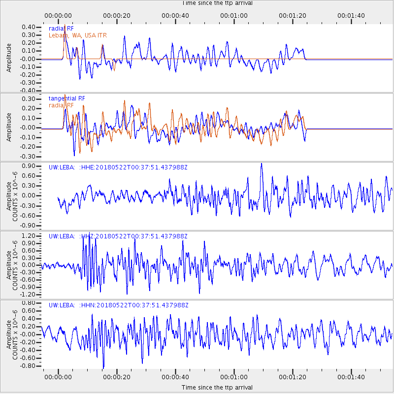
LEBA Lebam, WA, USA - Earthquake Result Viewer
*The percent match for this event was below the threshold and hence no stack was calculated.
| Earthquake location: |
South Of Mariana Islands |
| Earthquake latitude/longitude: |
12.8/145.8 |
| Earthquake time(UTC): |
2018/05/22 (142) 00:26:04 GMT |
| Earthquake Depth: |
10 km |
| Earthquake Magnitude: |
6.0 Mi |
| Earthquake Catalog/Contributor: |
NEIC PDE/pt |
|
| Network: |
UW Pacific Northwest Regional Seismic Network |
| Station: |
LEBA Lebam, WA, USA |
| Lat/Lon: |
46.55 N/123.56 W |
| Elevation: |
73 m |
|
| Distance: |
81.3 deg |
| Az: |
44.278 deg |
| Baz: |
279.308 deg |
| Ray Param: |
$rayparam |
*The percent match for this event was below the threshold and hence was not used in the summary stack. |
|
| Radial Match: |
61.04086 % |
| Radial Bump: |
400 |
| Transverse Match: |
65.569626 % |
| Transverse Bump: |
400 |
| SOD ConfigId: |
13570011 |
| Insert Time: |
2019-04-30 07:18:56.582 +0000 |
| GWidth: |
2.5 |
| Max Bumps: |
400 |
| Tol: |
0.001 |
|
Signal To Noise
| Channel | StoN | STA | LTA |
| UW:LEBA: :HHZ:20180522T00:37:51.437988Z | 0.40721652 | 6.4090045E-8 | 1.5738567E-7 |
| UW:LEBA: :HHN:20180522T00:37:51.437988Z | 1.3221041 | 2.0042151E-7 | 1.5159284E-7 |
| UW:LEBA: :HHE:20180522T00:37:51.437988Z | 0.7409307 | 1.305065E-7 | 1.7613861E-7 |
| Arrivals |
| Ps | |
| PpPs | |
| PsPs/PpSs | |


