You are here: Home > Network List > TA - USArray Transportable Network (new EarthScope stations) Stations List
> Station L23A Garrett, WY, USA > Earthquake Result Viewer
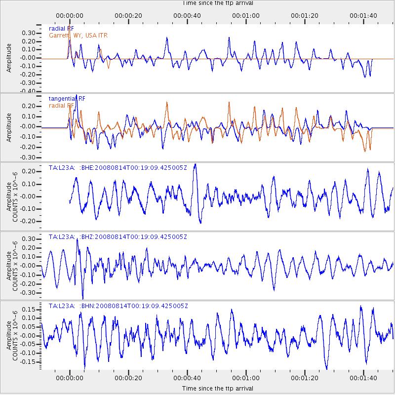
L23A Garrett, WY, USA - Earthquake Result Viewer
*The percent match for this event was below the threshold and hence no stack was calculated.
| Earthquake location: |
Mariana Islands |
| Earthquake latitude/longitude: |
16.4/146.9 |
| Earthquake time(UTC): |
2008/08/14 (227) 00:06:40 GMT |
| Earthquake Depth: |
53 km |
| Earthquake Magnitude: |
5.5 MB, 4.8 MS |
| Earthquake Catalog/Contributor: |
WHDF/NEIC |
|
| Network: |
TA USArray Transportable Network (new EarthScope stations) |
| Station: |
L23A Garrett, WY, USA |
| Lat/Lon: |
42.11 N/105.70 W |
| Elevation: |
2153 m |
|
| Distance: |
91.5 deg |
| Az: |
45.263 deg |
| Baz: |
293.622 deg |
| Ray Param: |
$rayparam |
*The percent match for this event was below the threshold and hence was not used in the summary stack. |
|
| Radial Match: |
37.693737 % |
| Radial Bump: |
380 |
| Transverse Match: |
50.118538 % |
| Transverse Bump: |
400 |
| SOD ConfigId: |
2504 |
| Insert Time: |
2010-03-06 11:23:15.563 +0000 |
| GWidth: |
2.5 |
| Max Bumps: |
400 |
| Tol: |
0.001 |
|
Signal To Noise
| Channel | StoN | STA | LTA |
| TA:L23A: :BHZ:20080814T00:19:09.425005Z | 2.01181 | 1.6253456E-7 | 8.0790215E-8 |
| TA:L23A: :BHN:20080814T00:19:09.425005Z | 1.0836965 | 8.270249E-8 | 7.631518E-8 |
| TA:L23A: :BHE:20080814T00:19:09.425005Z | 0.60345626 | 4.912775E-8 | 8.1410626E-8 |
| Arrivals |
| Ps | |
| PpPs | |
| PsPs/PpSs | |


