You are here: Home > Network List > TA - USArray Transportable Network (new EarthScope stations) Stations List
> Station L23A Garrett, WY, USA > Earthquake Result Viewer
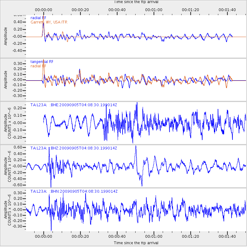
L23A Garrett, WY, USA - Earthquake Result Viewer
*The percent match for this event was below the threshold and hence no stack was calculated.
| Earthquake location: |
Southern Peru |
| Earthquake latitude/longitude: |
-15.1/-70.2 |
| Earthquake time(UTC): |
2009/09/05 (248) 03:58:39 GMT |
| Earthquake Depth: |
210 km |
| Earthquake Magnitude: |
5.8 MW, 5.2 MB, 5.8 MW |
| Earthquake Catalog/Contributor: |
WHDF/NEIC |
|
| Network: |
TA USArray Transportable Network (new EarthScope stations) |
| Station: |
L23A Garrett, WY, USA |
| Lat/Lon: |
42.11 N/105.70 W |
| Elevation: |
2153 m |
|
| Distance: |
65.7 deg |
| Az: |
331.726 deg |
| Baz: |
142.058 deg |
| Ray Param: |
$rayparam |
*The percent match for this event was below the threshold and hence was not used in the summary stack. |
|
| Radial Match: |
62.05455 % |
| Radial Bump: |
400 |
| Transverse Match: |
48.85118 % |
| Transverse Bump: |
400 |
| SOD ConfigId: |
2622 |
| Insert Time: |
2010-03-06 11:23:37.708 +0000 |
| GWidth: |
2.5 |
| Max Bumps: |
400 |
| Tol: |
0.001 |
|
Signal To Noise
| Channel | StoN | STA | LTA |
| TA:L23A: :BHZ:20090905T04:08:30.199014Z | 3.6747108 | 2.084907E-7 | 5.6736628E-8 |
| TA:L23A: :BHN:20090905T04:08:30.199014Z | 2.5031552 | 9.71303E-8 | 3.8803147E-8 |
| TA:L23A: :BHE:20090905T04:08:30.199014Z | 1.2836856 | 9.078282E-8 | 7.0720446E-8 |
| Arrivals |
| Ps | |
| PpPs | |
| PsPs/PpSs | |


