You are here: Home > Network List > TA - USArray Transportable Network (new EarthScope stations) Stations List
> Station L23A Garrett, WY, USA > Earthquake Result Viewer
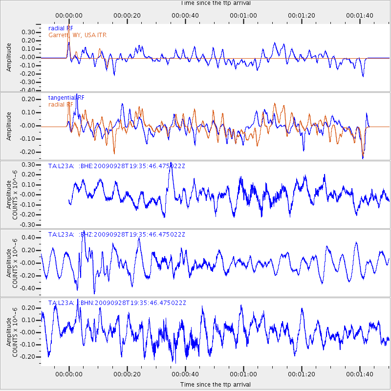
L23A Garrett, WY, USA - Earthquake Result Viewer
*The percent match for this event was below the threshold and hence no stack was calculated.
| Earthquake location: |
Ryukyu Islands, Japan |
| Earthquake latitude/longitude: |
27.9/127.8 |
| Earthquake time(UTC): |
2009/09/28 (271) 19:22:57 GMT |
| Earthquake Depth: |
9.0 km |
| Earthquake Magnitude: |
5.7 MB, 5.6 MS, 5.8 MW, 5.8 MW |
| Earthquake Catalog/Contributor: |
WHDF/NEIC |
|
| Network: |
TA USArray Transportable Network (new EarthScope stations) |
| Station: |
L23A Garrett, WY, USA |
| Lat/Lon: |
42.11 N/105.70 W |
| Elevation: |
2153 m |
|
| Distance: |
94.6 deg |
| Az: |
36.885 deg |
| Baz: |
314.456 deg |
| Ray Param: |
$rayparam |
*The percent match for this event was below the threshold and hence was not used in the summary stack. |
|
| Radial Match: |
44.72134 % |
| Radial Bump: |
400 |
| Transverse Match: |
50.577347 % |
| Transverse Bump: |
400 |
| SOD ConfigId: |
2622 |
| Insert Time: |
2010-03-06 11:23:42.101 +0000 |
| GWidth: |
2.5 |
| Max Bumps: |
400 |
| Tol: |
0.001 |
|
Signal To Noise
| Channel | StoN | STA | LTA |
| TA:L23A: :BHZ:20090928T19:35:46.475022Z | 2.3226628 | 2.2032555E-7 | 9.485903E-8 |
| TA:L23A: :BHN:20090928T19:35:46.475022Z | 1.4183125 | 1.5330284E-7 | 1.08088194E-7 |
| TA:L23A: :BHE:20090928T19:35:46.475022Z | 1.8537774 | 1.3389456E-7 | 7.2227955E-8 |
| Arrivals |
| Ps | |
| PpPs | |
| PsPs/PpSs | |


