You are here: Home > Network List > TA - USArray Transportable Network (new EarthScope stations) Stations List
> Station L23A Garrett, WY, USA > Earthquake Result Viewer
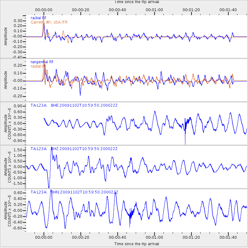
L23A Garrett, WY, USA - Earthquake Result Viewer
*The percent match for this event was below the threshold and hence no stack was calculated.
| Earthquake location: |
South Of Tonga Islands |
| Earthquake latitude/longitude: |
-24.1/-175.2 |
| Earthquake time(UTC): |
2009/11/02 (306) 10:47:13 GMT |
| Earthquake Depth: |
9.0 km |
| Earthquake Magnitude: |
6.1 MB, 6.1 MS, 6.2 MW, 6.1 MW |
| Earthquake Catalog/Contributor: |
WHDF/NEIC |
|
| Network: |
TA USArray Transportable Network (new EarthScope stations) |
| Station: |
L23A Garrett, WY, USA |
| Lat/Lon: |
42.11 N/105.70 W |
| Elevation: |
2153 m |
|
| Distance: |
91.9 deg |
| Az: |
44.201 deg |
| Baz: |
238.887 deg |
| Ray Param: |
$rayparam |
*The percent match for this event was below the threshold and hence was not used in the summary stack. |
|
| Radial Match: |
57.796944 % |
| Radial Bump: |
340 |
| Transverse Match: |
60.843224 % |
| Transverse Bump: |
400 |
| SOD ConfigId: |
2622 |
| Insert Time: |
2010-03-06 11:24:02.345 +0000 |
| GWidth: |
2.5 |
| Max Bumps: |
400 |
| Tol: |
0.001 |
|
Signal To Noise
| Channel | StoN | STA | LTA |
| TA:L23A: :BHZ:20091102T10:59:50.200022Z | 5.6394033 | 9.684096E-7 | 1.7172201E-7 |
| TA:L23A: :BHN:20091102T10:59:50.200022Z | 2.233763 | 4.1629636E-7 | 1.863655E-7 |
| TA:L23A: :BHE:20091102T10:59:50.200022Z | 1.9716707 | 2.4765697E-7 | 1.2560767E-7 |
| Arrivals |
| Ps | |
| PpPs | |
| PsPs/PpSs | |


