You are here: Home > Network List > TA - USArray Transportable Network (new EarthScope stations) Stations List
> Station L23A Garrett, WY, USA > Earthquake Result Viewer
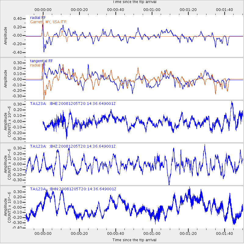
L23A Garrett, WY, USA - Earthquake Result Viewer
*The percent match for this event was below the threshold and hence no stack was calculated.
| Earthquake location: |
Off East Coast Of Honshu, Japan |
| Earthquake latitude/longitude: |
38.5/143.0 |
| Earthquake time(UTC): |
2008/12/05 (340) 20:03:11 GMT |
| Earthquake Depth: |
34 km |
| Earthquake Magnitude: |
5.5 MW, 5.2 MS, 5.2 MB, 5.5 MW |
| Earthquake Catalog/Contributor: |
WHDF/NEIC |
|
| Network: |
TA USArray Transportable Network (new EarthScope stations) |
| Station: |
L23A Garrett, WY, USA |
| Lat/Lon: |
42.11 N/105.70 W |
| Elevation: |
2153 m |
|
| Distance: |
78.3 deg |
| Az: |
45.065 deg |
| Baz: |
311.735 deg |
| Ray Param: |
$rayparam |
*The percent match for this event was below the threshold and hence was not used in the summary stack. |
|
| Radial Match: |
48.754387 % |
| Radial Bump: |
400 |
| Transverse Match: |
22.619007 % |
| Transverse Bump: |
400 |
| SOD ConfigId: |
2658 |
| Insert Time: |
2010-03-06 11:24:13.786 +0000 |
| GWidth: |
2.5 |
| Max Bumps: |
400 |
| Tol: |
0.001 |
|
Signal To Noise
| Channel | StoN | STA | LTA |
| TA:L23A: :BHZ:20081205T20:14:36.649001Z | 0.6370285 | 9.0117226E-8 | 1.4146498E-7 |
| TA:L23A: :BHN:20081205T20:14:36.649001Z | 2.112483 | 2.340524E-7 | 1.1079492E-7 |
| TA:L23A: :BHE:20081205T20:14:36.649001Z | 1.0571117 | 8.2336044E-8 | 7.7887734E-8 |
| Arrivals |
| Ps | |
| PpPs | |
| PsPs/PpSs | |


