You are here: Home > Network List > IU - Global Seismograph Network (GSN - IRIS/USGS) Stations List
> Station RSSD Black Hills, South Dakota, USA > Earthquake Result Viewer
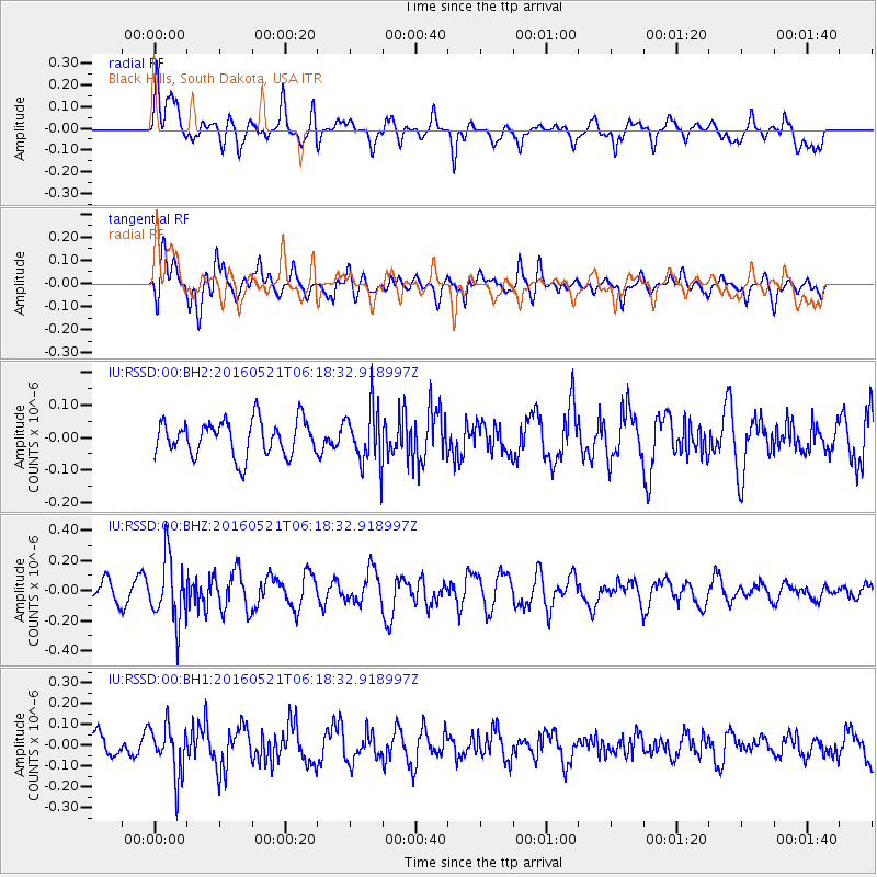
RSSD Black Hills, South Dakota, USA - Earthquake Result Viewer
*The percent match for this event was below the threshold and hence no stack was calculated.
| Earthquake location: |
Southeast Of Honshu, Japan |
| Earthquake latitude/longitude: |
30.9/140.1 |
| Earthquake time(UTC): |
2016/05/21 (142) 06:06:42 GMT |
| Earthquake Depth: |
130 km |
| Earthquake Magnitude: |
5.5 MB |
| Earthquake Catalog/Contributor: |
NEIC PDE/NEIC COMCAT |
|
| Network: |
IU Global Seismograph Network (GSN - IRIS/USGS) |
| Station: |
RSSD Black Hills, South Dakota, USA |
| Lat/Lon: |
44.12 N/104.04 W |
| Elevation: |
2090 m |
|
| Distance: |
85.2 deg |
| Az: |
40.555 deg |
| Baz: |
309.129 deg |
| Ray Param: |
$rayparam |
*The percent match for this event was below the threshold and hence was not used in the summary stack. |
|
| Radial Match: |
48.68144 % |
| Radial Bump: |
400 |
| Transverse Match: |
60.21271 % |
| Transverse Bump: |
400 |
| SOD ConfigId: |
1475611 |
| Insert Time: |
2016-06-04 06:11:40.314 +0000 |
| GWidth: |
2.5 |
| Max Bumps: |
400 |
| Tol: |
0.001 |
|
Signal To Noise
| Channel | StoN | STA | LTA |
| IU:RSSD:00:BHZ:20160521T06:18:32.918997Z | 2.3667781 | 2.1295045E-7 | 8.997483E-8 |
| IU:RSSD:00:BH1:20160521T06:18:32.918997Z | 1.7526219 | 1.19689E-7 | 6.82914E-8 |
| IU:RSSD:00:BH2:20160521T06:18:32.918997Z | 1.5934298 | 8.6871346E-8 | 5.4518463E-8 |
| Arrivals |
| Ps | |
| PpPs | |
| PsPs/PpSs | |


