You are here: Home > Network List > TA - USArray Transportable Network (new EarthScope stations) Stations List
> Station J22A Midwest, WY, USA > Earthquake Result Viewer
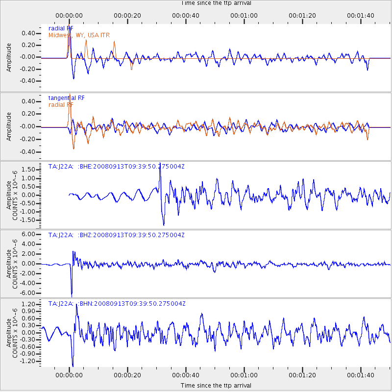
J22A Midwest, WY, USA - Earthquake Result Viewer
*The percent match for this event was below the threshold and hence no stack was calculated.
| Earthquake location: |
Colombia |
| Earthquake latitude/longitude: |
4.8/-75.5 |
| Earthquake time(UTC): |
2008/09/13 (257) 09:32:01 GMT |
| Earthquake Depth: |
133 km |
| Earthquake Magnitude: |
5.9 MB, 5.7 MW, 5.7 MW |
| Earthquake Catalog/Contributor: |
WHDF/NEIC |
|
| Network: |
TA USArray Transportable Network (new EarthScope stations) |
| Station: |
J22A Midwest, WY, USA |
| Lat/Lon: |
43.41 N/106.48 W |
| Elevation: |
1587 m |
|
| Distance: |
47.2 deg |
| Az: |
329.268 deg |
| Baz: |
135.667 deg |
| Ray Param: |
$rayparam |
*The percent match for this event was below the threshold and hence was not used in the summary stack. |
|
| Radial Match: |
61.647938 % |
| Radial Bump: |
400 |
| Transverse Match: |
57.996704 % |
| Transverse Bump: |
400 |
| SOD ConfigId: |
2560 |
| Insert Time: |
2010-03-06 11:26:21.316 +0000 |
| GWidth: |
2.5 |
| Max Bumps: |
400 |
| Tol: |
0.001 |
|
Signal To Noise
| Channel | StoN | STA | LTA |
| TA:J22A: :BHZ:20080913T09:39:50.275004Z | 10.7930765 | 1.7643565E-6 | 1.6347114E-7 |
| TA:J22A: :BHN:20080913T09:39:50.275004Z | 3.0861635 | 5.7308546E-7 | 1.856951E-7 |
| TA:J22A: :BHE:20080913T09:39:50.275004Z | 5.2286034 | 8.3899124E-7 | 1.6046182E-7 |
| Arrivals |
| Ps | |
| PpPs | |
| PsPs/PpSs | |


