You are here: Home > Network List > TA - USArray Transportable Network (new EarthScope stations) Stations List
> Station 435B Jarrell, TX, USA > Earthquake Result Viewer
435B Jarrell, TX, USA - Earthquake Result Viewer

| Earthquake location: |
Central Mid-Atlantic Ridge |
| Earthquake latitude/longitude: |
7.4/-36.2 |
| Earthquake time(UTC): |
2018/05/23 (143) 05:44:43 GMT |
| Earthquake Depth: |
10 km |
| Earthquake Magnitude: |
5.5 Mww |
| Earthquake Catalog/Contributor: |
NEIC PDE/us |
|
| Network: |
TA USArray Transportable Network (new EarthScope stations) |
| Station: |
435B Jarrell, TX, USA |
| Lat/Lon: |
30.78 N/97.58 W |
| Elevation: |
248 m |
|
| Distance: |
61.7 deg |
| Az: |
300.912 deg |
| Baz: |
98.616 deg |
| Ray Param: |
0.060707733 |
| Estimated Moho Depth: |
25.25 km |
| Estimated Crust Vp/Vs: |
1.87 |
| Assumed Crust Vp: |
6.347 km/s |
| Estimated Crust Vs: |
3.403 km/s |
| Estimated Crust Poisson's Ratio: |
0.30 |
|
| Radial Match: |
80.7022 % |
| Radial Bump: |
400 |
| Transverse Match: |
62.396843 % |
| Transverse Bump: |
400 |
| SOD ConfigId: |
13570011 |
| Insert Time: |
2019-04-30 07:40:28.683 +0000 |
| GWidth: |
2.5 |
| Max Bumps: |
400 |
| Tol: |
0.001 |
|
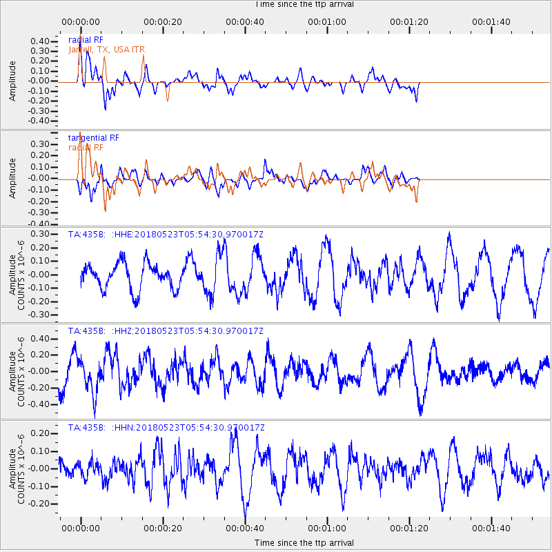
Signal To Noise
| Channel | StoN | STA | LTA |
| TA:435B: :HHZ:20180523T05:54:30.970017Z | 1.9607778 | 2.051677E-7 | 1.0463587E-7 |
| TA:435B: :HHN:20180523T05:54:30.970017Z | 0.450513 | 4.2183345E-8 | 9.363403E-8 |
| TA:435B: :HHE:20180523T05:54:30.970017Z | 1.530009 | 1.4441378E-7 | 9.438753E-8 |
| Arrivals |
| Ps | 3.6 SECOND |
| PpPs | 11 SECOND |
| PsPs/PpSs | 15 SECOND |


