You are here: Home > Network List > TA - USArray Transportable Network (new EarthScope stations) Stations List
> Station L44A Lake County Forest Preserve, Grayslake, IL, USA > Earthquake Result Viewer
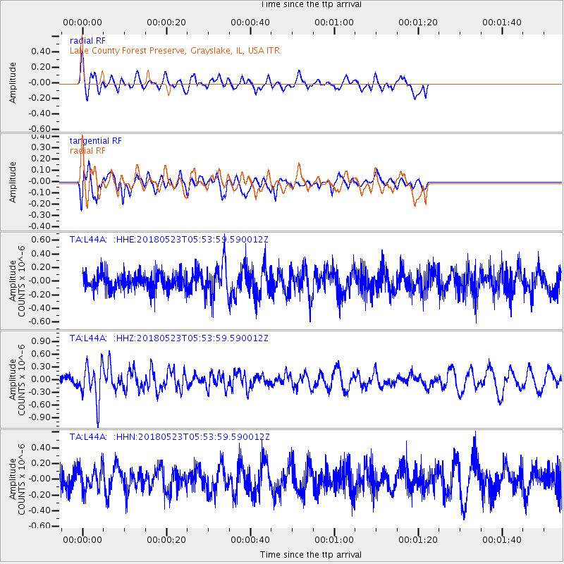
L44A Lake County Forest Preserve, Grayslake, IL, USA - Earthquake Result Viewer
*The percent match for this event was below the threshold and hence no stack was calculated.
| Earthquake location: |
Central Mid-Atlantic Ridge |
| Earthquake latitude/longitude: |
7.4/-36.2 |
| Earthquake time(UTC): |
2018/05/23 (143) 05:44:43 GMT |
| Earthquake Depth: |
10 km |
| Earthquake Magnitude: |
5.5 Mww |
| Earthquake Catalog/Contributor: |
NEIC PDE/us |
|
| Network: |
TA USArray Transportable Network (new EarthScope stations) |
| Station: |
L44A Lake County Forest Preserve, Grayslake, IL, USA |
| Lat/Lon: |
42.18 N/87.91 W |
| Elevation: |
202 m |
|
| Distance: |
57.1 deg |
| Az: |
316.024 deg |
| Baz: |
112.106 deg |
| Ray Param: |
$rayparam |
*The percent match for this event was below the threshold and hence was not used in the summary stack. |
|
| Radial Match: |
55.154167 % |
| Radial Bump: |
400 |
| Transverse Match: |
56.59883 % |
| Transverse Bump: |
400 |
| SOD ConfigId: |
13570011 |
| Insert Time: |
2019-04-30 07:40:48.429 +0000 |
| GWidth: |
2.5 |
| Max Bumps: |
400 |
| Tol: |
0.001 |
|
Signal To Noise
| Channel | StoN | STA | LTA |
| TA:L44A: :HHZ:20180523T05:53:59.590012Z | 3.789606 | 4.2138637E-7 | 1.111953E-7 |
| TA:L44A: :HHN:20180523T05:53:59.590012Z | 1.0014312 | 1.3837843E-7 | 1.3818065E-7 |
| TA:L44A: :HHE:20180523T05:53:59.590012Z | 2.0005322 | 2.4819363E-7 | 1.240638E-7 |
| Arrivals |
| Ps | |
| PpPs | |
| PsPs/PpSs | |


