You are here: Home > Network List > US - United States National Seismic Network Stations List
> Station AMTX Amarillo, Texas, USA > Earthquake Result Viewer
AMTX Amarillo, Texas, USA - Earthquake Result Viewer
*The percent match for this event was below the threshold and hence no stack was calculated.
| Earthquake location: |
Southeast Of Honshu, Japan |
| Earthquake latitude/longitude: |
30.9/140.1 |
| Earthquake time(UTC): |
2016/05/21 (142) 06:06:42 GMT |
| Earthquake Depth: |
130 km |
| Earthquake Magnitude: |
5.5 MB |
| Earthquake Catalog/Contributor: |
NEIC PDE/NEIC COMCAT |
|
| Network: |
US United States National Seismic Network |
| Station: |
AMTX Amarillo, Texas, USA |
| Lat/Lon: |
34.53 N/101.41 W |
| Elevation: |
1010 m |
|
| Distance: |
92.9 deg |
| Az: |
46.574 deg |
| Baz: |
310.897 deg |
| Ray Param: |
$rayparam |
*The percent match for this event was below the threshold and hence was not used in the summary stack. |
|
| Radial Match: |
23.977251 % |
| Radial Bump: |
400 |
| Transverse Match: |
40.79354 % |
| Transverse Bump: |
400 |
| SOD ConfigId: |
1475611 |
| Insert Time: |
2016-06-04 06:16:08.986 +0000 |
| GWidth: |
2.5 |
| Max Bumps: |
400 |
| Tol: |
0.001 |
|
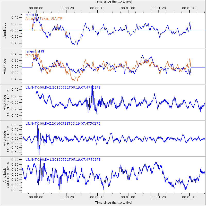
Signal To Noise
| Channel | StoN | STA | LTA |
| US:AMTX:00:BHZ:20160521T06:19:07.475027Z | 3.0803208 | 2.8267135E-7 | 9.176685E-8 |
| US:AMTX:00:BH1:20160521T06:19:07.475027Z | 1.0721927 | 1.640779E-7 | 1.5303024E-7 |
| US:AMTX:00:BH2:20160521T06:19:07.475027Z | 1.3407735 | 1.5200548E-7 | 1.1337149E-7 |
| Arrivals |
| Ps | |
| PpPs | |
| PsPs/PpSs | |


