You are here: Home > Network List > TA - USArray Transportable Network (new EarthScope stations) Stations List
> Station J22A Midwest, WY, USA > Earthquake Result Viewer
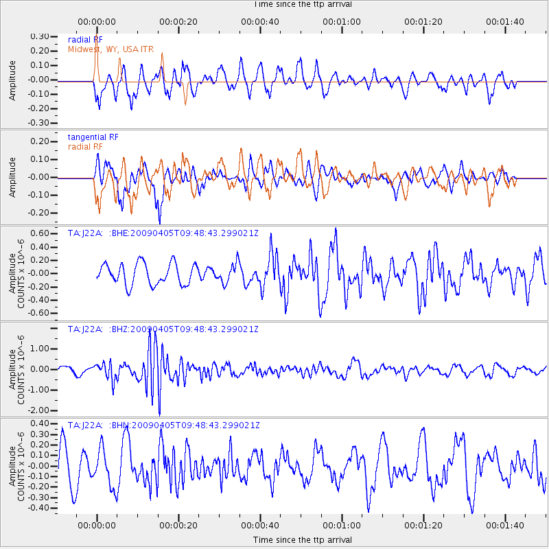
J22A Midwest, WY, USA - Earthquake Result Viewer
*The percent match for this event was below the threshold and hence no stack was calculated.
| Earthquake location: |
Kyushu, Japan |
| Earthquake latitude/longitude: |
32.0/131.4 |
| Earthquake time(UTC): |
2009/04/05 (095) 09:36:26 GMT |
| Earthquake Depth: |
26 km |
| Earthquake Magnitude: |
5.8 MB, 5.4 MS, 5.8 MW, 5.8 MW |
| Earthquake Catalog/Contributor: |
WHDF/NEIC |
|
| Network: |
TA USArray Transportable Network (new EarthScope stations) |
| Station: |
J22A Midwest, WY, USA |
| Lat/Lon: |
43.41 N/106.48 W |
| Elevation: |
1587 m |
|
| Distance: |
88.2 deg |
| Az: |
38.142 deg |
| Baz: |
313.943 deg |
| Ray Param: |
$rayparam |
*The percent match for this event was below the threshold and hence was not used in the summary stack. |
|
| Radial Match: |
62.07483 % |
| Radial Bump: |
400 |
| Transverse Match: |
64.96862 % |
| Transverse Bump: |
400 |
| SOD ConfigId: |
2658 |
| Insert Time: |
2010-03-06 11:27:43.812 +0000 |
| GWidth: |
2.5 |
| Max Bumps: |
400 |
| Tol: |
0.001 |
|
Signal To Noise
| Channel | StoN | STA | LTA |
| TA:J22A: :BHZ:20090405T09:48:43.299021Z | 2.6938038 | 4.062908E-7 | 1.508242E-7 |
| TA:J22A: :BHN:20090405T09:48:43.299021Z | 1.2479221 | 1.7930134E-7 | 1.4367993E-7 |
| TA:J22A: :BHE:20090405T09:48:43.299021Z | 0.90678096 | 1.4446974E-7 | 1.5932154E-7 |
| Arrivals |
| Ps | |
| PpPs | |
| PsPs/PpSs | |


