You are here: Home > Network List > US - United States National Seismic Network Stations List
> Station DUG Dugway, Tooele County, Utah, USA > Earthquake Result Viewer
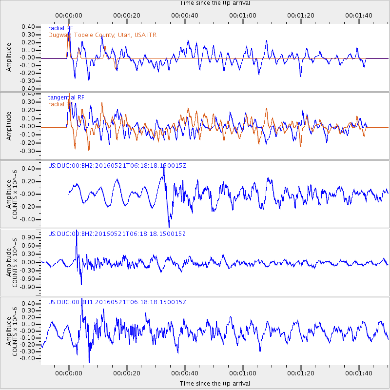
DUG Dugway, Tooele County, Utah, USA - Earthquake Result Viewer
*The percent match for this event was below the threshold and hence no stack was calculated.
| Earthquake location: |
Southeast Of Honshu, Japan |
| Earthquake latitude/longitude: |
30.9/140.1 |
| Earthquake time(UTC): |
2016/05/21 (142) 06:06:42 GMT |
| Earthquake Depth: |
130 km |
| Earthquake Magnitude: |
5.5 MB |
| Earthquake Catalog/Contributor: |
NEIC PDE/NEIC COMCAT |
|
| Network: |
US United States National Seismic Network |
| Station: |
DUG Dugway, Tooele County, Utah, USA |
| Lat/Lon: |
40.19 N/112.81 W |
| Elevation: |
1477 m |
|
| Distance: |
82.2 deg |
| Az: |
47.628 deg |
| Baz: |
304.027 deg |
| Ray Param: |
$rayparam |
*The percent match for this event was below the threshold and hence was not used in the summary stack. |
|
| Radial Match: |
53.87763 % |
| Radial Bump: |
400 |
| Transverse Match: |
72.2432 % |
| Transverse Bump: |
400 |
| SOD ConfigId: |
1475611 |
| Insert Time: |
2016-06-04 06:16:35.485 +0000 |
| GWidth: |
2.5 |
| Max Bumps: |
400 |
| Tol: |
0.001 |
|
Signal To Noise
| Channel | StoN | STA | LTA |
| US:DUG:00:BHZ:20160521T06:18:18.150015Z | 5.327347 | 3.127912E-7 | 5.8714257E-8 |
| US:DUG:00:BH1:20160521T06:18:18.150015Z | 1.8240446 | 1.8727145E-7 | 1.02668245E-7 |
| US:DUG:00:BH2:20160521T06:18:18.150015Z | 2.2712996 | 2.4103468E-7 | 1.0612192E-7 |
| Arrivals |
| Ps | |
| PpPs | |
| PsPs/PpSs | |


