You are here: Home > Network List > UW - Pacific Northwest Regional Seismic Network Stations List
> Station UMAT Pilot Rock, OR, USA > Earthquake Result Viewer
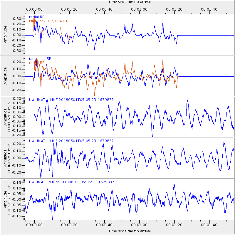
UMAT Pilot Rock, OR, USA - Earthquake Result Viewer
*The percent match for this event was below the threshold and hence no stack was calculated.
| Earthquake location: |
South Of Kermadec Islands |
| Earthquake latitude/longitude: |
-33.1/-179.4 |
| Earthquake time(UTC): |
2018/06/01 (152) 04:52:30 GMT |
| Earthquake Depth: |
10 km |
| Earthquake Magnitude: |
5.6 Mww |
| Earthquake Catalog/Contributor: |
NEIC PDE/us |
|
| Network: |
UW Pacific Northwest Regional Seismic Network |
| Station: |
UMAT Pilot Rock, OR, USA |
| Lat/Lon: |
45.29 N/118.96 W |
| Elevation: |
1318 m |
|
| Distance: |
95.3 deg |
| Az: |
38.072 deg |
| Baz: |
227.187 deg |
| Ray Param: |
$rayparam |
*The percent match for this event was below the threshold and hence was not used in the summary stack. |
|
| Radial Match: |
61.764244 % |
| Radial Bump: |
400 |
| Transverse Match: |
58.802105 % |
| Transverse Bump: |
400 |
| SOD ConfigId: |
13570011 |
| Insert Time: |
2019-04-30 07:56:47.785 +0000 |
| GWidth: |
2.5 |
| Max Bumps: |
400 |
| Tol: |
0.001 |
|
Signal To Noise
| Channel | StoN | STA | LTA |
| UW:UMAT: :HHZ:20180601T05:05:23.167983Z | 2.6755323 | 1.1628898E-7 | 4.3463867E-8 |
| UW:UMAT: :HHN:20180601T05:05:23.167983Z | 0.35822737 | 2.2022949E-8 | 6.1477564E-8 |
| UW:UMAT: :HHE:20180601T05:05:23.167983Z | 0.91376364 | 7.697369E-8 | 8.4238074E-8 |
| Arrivals |
| Ps | |
| PpPs | |
| PsPs/PpSs | |


