You are here: Home > Network List > US - United States National Seismic Network Stations List
> Station WUAZ Wupatki, Arizona, USA > Earthquake Result Viewer
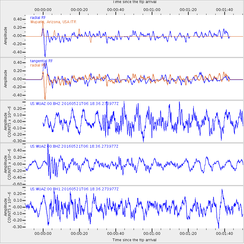
WUAZ Wupatki, Arizona, USA - Earthquake Result Viewer
*The percent match for this event was below the threshold and hence no stack was calculated.
| Earthquake location: |
Southeast Of Honshu, Japan |
| Earthquake latitude/longitude: |
30.9/140.1 |
| Earthquake time(UTC): |
2016/05/21 (142) 06:06:42 GMT |
| Earthquake Depth: |
130 km |
| Earthquake Magnitude: |
5.5 MB |
| Earthquake Catalog/Contributor: |
NEIC PDE/NEIC COMCAT |
|
| Network: |
US United States National Seismic Network |
| Station: |
WUAZ Wupatki, Arizona, USA |
| Lat/Lon: |
35.52 N/111.37 W |
| Elevation: |
1592 m |
|
| Distance: |
85.8 deg |
| Az: |
50.84 deg |
| Baz: |
305.242 deg |
| Ray Param: |
$rayparam |
*The percent match for this event was below the threshold and hence was not used in the summary stack. |
|
| Radial Match: |
46.214664 % |
| Radial Bump: |
400 |
| Transverse Match: |
63.747528 % |
| Transverse Bump: |
400 |
| SOD ConfigId: |
1475611 |
| Insert Time: |
2016-06-04 06:18:09.626 +0000 |
| GWidth: |
2.5 |
| Max Bumps: |
400 |
| Tol: |
0.001 |
|
Signal To Noise
| Channel | StoN | STA | LTA |
| US:WUAZ:00:BHZ:20160521T06:18:36.273977Z | 1.8200053 | 1.9828433E-7 | 1.0894712E-7 |
| US:WUAZ:00:BH1:20160521T06:18:36.273977Z | 1.4739093 | 1.2764482E-7 | 8.660291E-8 |
| US:WUAZ:00:BH2:20160521T06:18:36.273977Z | 1.111233 | 1.0395579E-7 | 9.354995E-8 |
| Arrivals |
| Ps | |
| PpPs | |
| PsPs/PpSs | |


