You are here: Home > Network List > TA - USArray Transportable Network (new EarthScope stations) Stations List
> Station E21A Keefer Ranch, Vananda, MT, USA > Earthquake Result Viewer
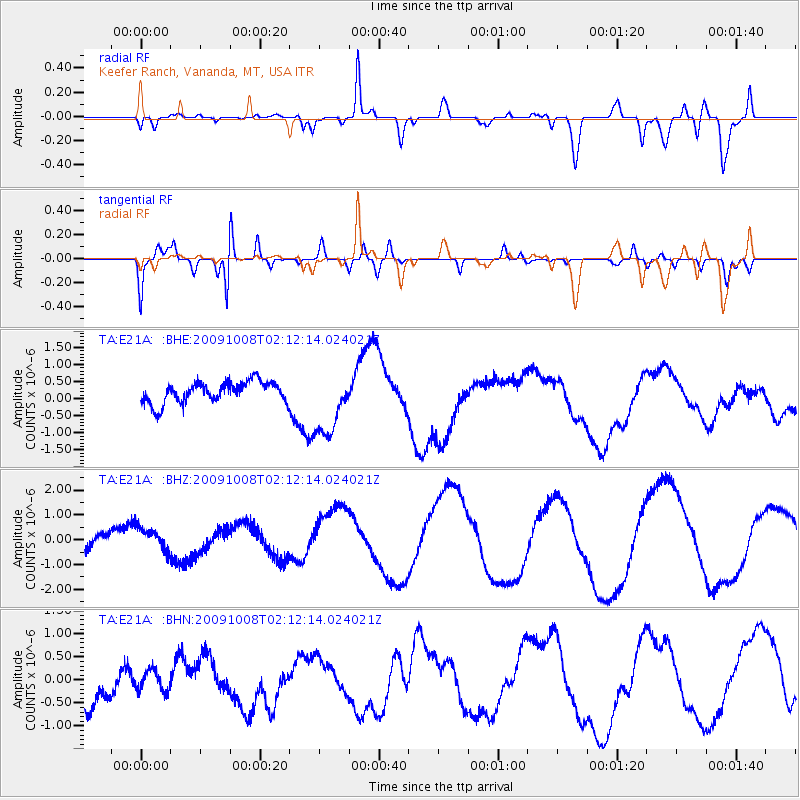
E21A Keefer Ranch, Vananda, MT, USA - Earthquake Result Viewer
*The percent match for this event was below the threshold and hence no stack was calculated.
| Earthquake location: |
Santa Cruz Islands |
| Earthquake latitude/longitude: |
-11.9/166.0 |
| Earthquake time(UTC): |
2009/10/08 (281) 01:59:19 GMT |
| Earthquake Depth: |
35 km |
| Earthquake Magnitude: |
5.9 MB |
| Earthquake Catalog/Contributor: |
WHDF/NEIC |
|
| Network: |
TA USArray Transportable Network (new EarthScope stations) |
| Station: |
E21A Keefer Ranch, Vananda, MT, USA |
| Lat/Lon: |
46.54 N/107.08 W |
| Elevation: |
834 m |
|
| Distance: |
96.5 deg |
| Az: |
43.924 deg |
| Baz: |
259.627 deg |
| Ray Param: |
$rayparam |
*The percent match for this event was below the threshold and hence was not used in the summary stack. |
|
| Radial Match: |
45.97901 % |
| Radial Bump: |
400 |
| Transverse Match: |
79.81556 % |
| Transverse Bump: |
400 |
| SOD ConfigId: |
2622 |
| Insert Time: |
2010-03-06 11:29:45.989 +0000 |
| GWidth: |
2.5 |
| Max Bumps: |
400 |
| Tol: |
0.001 |
|
Signal To Noise
| Channel | StoN | STA | LTA |
| TA:E21A: :BHZ:20091008T02:12:14.024021Z | 1.3360457 | 5.0016337E-7 | 3.7436095E-7 |
| TA:E21A: :BHN:20091008T02:12:14.024021Z | 0.43869346 | 2.2685207E-7 | 5.171084E-7 |
| TA:E21A: :BHE:20091008T02:12:14.024021Z | 3.1857512 | 9.782625E-7 | 3.0707437E-7 |
| Arrivals |
| Ps | |
| PpPs | |
| PsPs/PpSs | |


