You are here: Home > Network List > TA - USArray Transportable Network (new EarthScope stations) Stations List
> Station 121A Cookes Peak, Deming, NM, USA > Earthquake Result Viewer
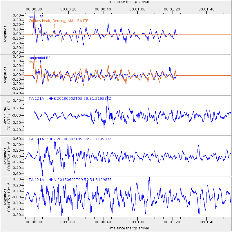
121A Cookes Peak, Deming, NM, USA - Earthquake Result Viewer
*The percent match for this event was below the threshold and hence no stack was calculated.
| Earthquake location: |
East Of Kuril Islands |
| Earthquake latitude/longitude: |
43.9/148.0 |
| Earthquake time(UTC): |
2018/06/02 (153) 09:48:08 GMT |
| Earthquake Depth: |
10 km |
| Earthquake Magnitude: |
5.5 Mww |
| Earthquake Catalog/Contributor: |
NEIC PDE/us |
|
| Network: |
TA USArray Transportable Network (new EarthScope stations) |
| Station: |
121A Cookes Peak, Deming, NM, USA |
| Lat/Lon: |
32.53 N/107.79 W |
| Elevation: |
1652 m |
|
| Distance: |
77.2 deg |
| Az: |
57.112 deg |
| Baz: |
314.106 deg |
| Ray Param: |
$rayparam |
*The percent match for this event was below the threshold and hence was not used in the summary stack. |
|
| Radial Match: |
73.9637 % |
| Radial Bump: |
296 |
| Transverse Match: |
65.54883 % |
| Transverse Bump: |
400 |
| SOD ConfigId: |
13570011 |
| Insert Time: |
2019-04-30 08:06:36.291 +0000 |
| GWidth: |
2.5 |
| Max Bumps: |
400 |
| Tol: |
0.001 |
|
Signal To Noise
| Channel | StoN | STA | LTA |
| TA:121A: :HHZ:20180602T09:59:31.319983Z | 3.0359454 | 2.3139971E-7 | 7.621998E-8 |
| TA:121A: :HHN:20180602T09:59:31.319983Z | 1.5280209 | 1.0620927E-7 | 6.950774E-8 |
| TA:121A: :HHE:20180602T09:59:31.319983Z | 1.4518691 | 8.246921E-8 | 5.6802097E-8 |
| Arrivals |
| Ps | |
| PpPs | |
| PsPs/PpSs | |


