You are here: Home > Network List > TA - USArray Transportable Network (new EarthScope stations) Stations List
> Station B18K Kokolik River, AK, USA > Earthquake Result Viewer
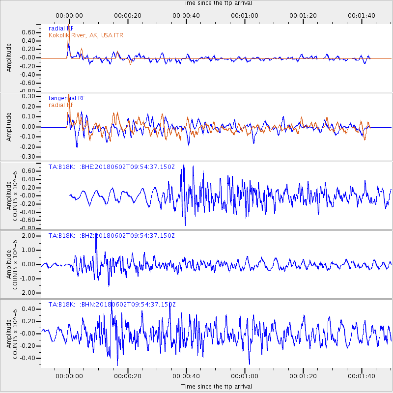
B18K Kokolik River, AK, USA - Earthquake Result Viewer
*The percent match for this event was below the threshold and hence no stack was calculated.
| Earthquake location: |
East Of Kuril Islands |
| Earthquake latitude/longitude: |
43.9/148.0 |
| Earthquake time(UTC): |
2018/06/02 (153) 09:48:08 GMT |
| Earthquake Depth: |
10 km |
| Earthquake Magnitude: |
5.5 Mww |
| Earthquake Catalog/Contributor: |
NEIC PDE/us |
|
| Network: |
TA USArray Transportable Network (new EarthScope stations) |
| Station: |
B18K Kokolik River, AK, USA |
| Lat/Lon: |
69.36 N/161.80 W |
| Elevation: |
222 m |
|
| Distance: |
35.8 deg |
| Az: |
27.705 deg |
| Baz: |
251.312 deg |
| Ray Param: |
$rayparam |
*The percent match for this event was below the threshold and hence was not used in the summary stack. |
|
| Radial Match: |
71.81409 % |
| Radial Bump: |
400 |
| Transverse Match: |
61.499348 % |
| Transverse Bump: |
400 |
| SOD ConfigId: |
13570011 |
| Insert Time: |
2019-04-30 08:06:43.074 +0000 |
| GWidth: |
2.5 |
| Max Bumps: |
400 |
| Tol: |
0.001 |
|
Signal To Noise
| Channel | StoN | STA | LTA |
| TA:B18K: :BHZ:20180602T09:54:37.150Z | 1.9943953 | 3.6917018E-7 | 1.8510381E-7 |
| TA:B18K: :BHN:20180602T09:54:37.150Z | 1.819537 | 1.1001024E-7 | 6.046057E-8 |
| TA:B18K: :BHE:20180602T09:54:37.150Z | 1.5869352 | 1.5800765E-7 | 9.9567806E-8 |
| Arrivals |
| Ps | |
| PpPs | |
| PsPs/PpSs | |


