You are here: Home > Network List > TA - USArray Transportable Network (new EarthScope stations) Stations List
> Station H16K Elim, AK, USA > Earthquake Result Viewer
H16K Elim, AK, USA - Earthquake Result Viewer
*The percent match for this event was below the threshold and hence no stack was calculated.
| Earthquake location: |
East Of Kuril Islands |
| Earthquake latitude/longitude: |
43.9/148.0 |
| Earthquake time(UTC): |
2018/06/02 (153) 09:48:08 GMT |
| Earthquake Depth: |
10 km |
| Earthquake Magnitude: |
5.5 Mww |
| Earthquake Catalog/Contributor: |
NEIC PDE/us |
|
| Network: |
TA USArray Transportable Network (new EarthScope stations) |
| Station: |
H16K Elim, AK, USA |
| Lat/Lon: |
64.64 N/162.24 W |
| Elevation: |
216 m |
|
| Distance: |
34.4 deg |
| Az: |
35.577 deg |
| Baz: |
257.354 deg |
| Ray Param: |
$rayparam |
*The percent match for this event was below the threshold and hence was not used in the summary stack. |
|
| Radial Match: |
72.43093 % |
| Radial Bump: |
400 |
| Transverse Match: |
69.281555 % |
| Transverse Bump: |
400 |
| SOD ConfigId: |
13570011 |
| Insert Time: |
2019-04-30 08:07:31.280 +0000 |
| GWidth: |
2.5 |
| Max Bumps: |
400 |
| Tol: |
0.001 |
|
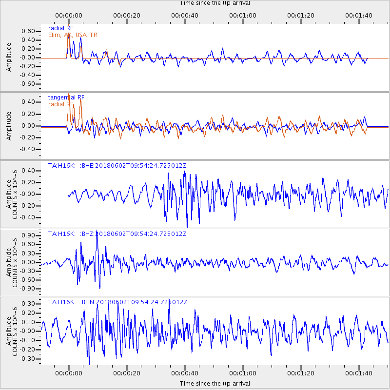
Signal To Noise
| Channel | StoN | STA | LTA |
| TA:H16K: :BHZ:20180602T09:54:24.725012Z | 5.900805 | 3.0414014E-7 | 5.154215E-8 |
| TA:H16K: :BHN:20180602T09:54:24.725012Z | 1.390793 | 8.1277925E-8 | 5.843999E-8 |
| TA:H16K: :BHE:20180602T09:54:24.725012Z | 2.7018917 | 1.893769E-7 | 7.0090486E-8 |
| Arrivals |
| Ps | |
| PpPs | |
| PsPs/PpSs | |


